
A BIM model built on the measured geometry of the existing building
We turn the point cloud or the measurements made by our team into a BIM model for architects, designers and building managers. We deliver in Archicad, Revit or IFC, at the level of detail agreed before quoting. You receive the estimate within 48 hours of complete data; the cost depends on floor area, complexity and LOD.
3D model, BIM or measured survey?
2D measured survey
Plans, sections and elevations extracted from measurements. Suitable when design needs DWG/PDF documentation without a full information model.
3D model
A three-dimensional representation of the geometry. It can be useful for visualisation and coordination, but it does not automatically contain the structure and information of a BIM model.
BIM model
Elements organised by category and level, ready for work in Archicad, Revit or via IFC exchange. The content is set by a modelling brief.
Point cloud, 2D plans or BIM model: which deliverable to choose →
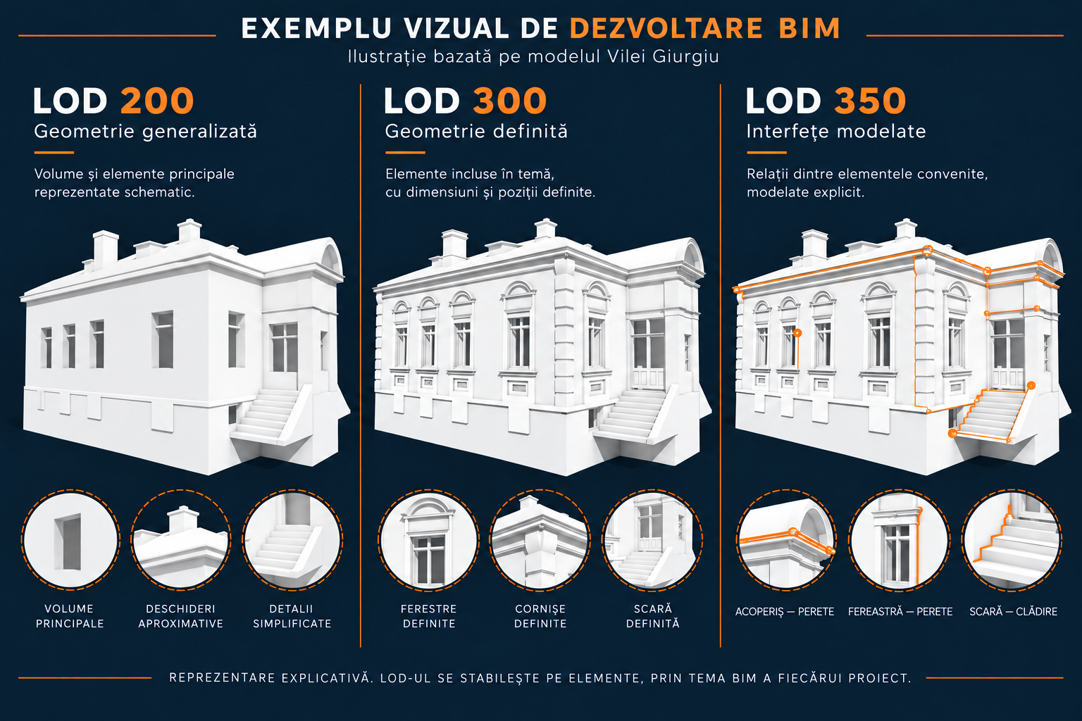
The level of detail is agreed before modelling
| Level | Indicative content | Typical use |
|---|---|---|
| LOD 200 | Volumes and main elements, with generalised geometry. | Studies, concept and early coordination. |
| LOD 300 | Defined dimensions and positions for the elements included in the brief. | Design on existing buildings and coordination between disciplines. |
| LOD 350 | Relationships and interfaces between modelled elements, only for the agreed areas and categories. | Detailed coordination and preparing interventions. |
Important: LOD does not describe measurement accuracy and does not mean every detail visible in the point cloud will be modelled. Tolerances, categories and exclusions are recorded in the modelling brief.
Working and delivery formats
BIM models
.pln for Archicad
.rvt for Revit
.ifc for interdisciplinary exchange
2D documentation
.dwg with organised layers and .pdf, according to the items agreed in the quote.
Measured data
.e57, .rcp or other agreed point cloud formats. Handover of raw data is not automatically included.
Project example: for Elias Ward in Băile Olănești — a medical complex of about 14,000 m², with connected blocks, different levels, arcades and columns — we carried out laser scanning inside and out in 7 days, then modelled the existing condition.
How we work
1. We check the data
We receive the point cloud, the available drawings and the project’s purpose. If measurements are missing, we quote 3D scanning separately.
2. We agree the BIM brief
We confirm the software, LOD, modelled categories, tolerances, phasing and handover formats.
3. We model and check
The model is built on the available data and checked against the accepted brief. The deadline is confirmed in the quote.
Frequently asked questions
Can you model a point cloud captured by another team?
Yes, after checking coverage, density, coordinate system and format. If the data does not allow the requested deliverable, we state the limits before quoting.
Do you work in Archicad and Revit?
Yes. The native format and software version are confirmed before the project starts. We can also deliver IFC for exchange between platforms.
Does LOD 350 mean you model every detail?
No. The LOD applies to the elements included in the modelling brief. Ornament, building services, decay and hidden elements are handled separately.
Does the BIM model replace the assessment or the architectural design?
No. The model documents and organises the existing condition; design and assessment decisions belong to licensed specialists.
How much does it cost and how long does it take?
The quote and deadline are set after checking the data, floor area, complexity and BIM brief. The estimate is sent within 48 hours of receiving complete information.
Already have the point cloud or the drawings?
Send us the format, approximate floor area, preferred software and the purpose of the model. We tell you what we can deliver and what information is missing.