
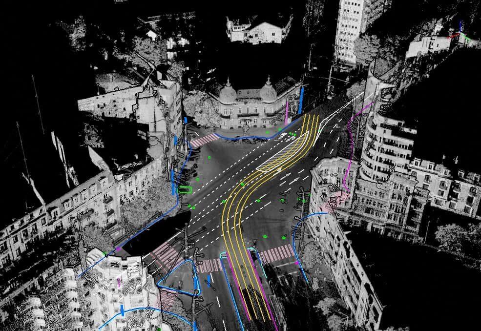
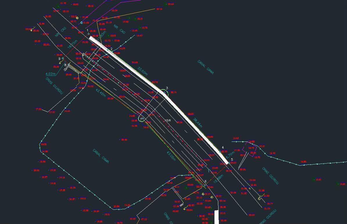
Topographic plans in Bucharest — delivered fast, in DWG format with real levels. Topographic survey, 3D laser scanning of existing buildings, site plan in the Stereo 70 system, documentation for building permits, PUD or PUZ.
See a sample topographic plan from UAV data and 3D laser scanning →
Operational base in Sector 5 (Panduri) and a field office in Sector 1 (9 Crișana St., intercom 10). We survey in every sector of Bucharest and in Ilfov, with no extra travel charge for standard jobs.
Delivery: from 7 working days · Area: all sectors of Bucharest + Ilfov · Price: from 400 EUR + VAT
When you need a topographic plan in Bucharest
- Building permit — new building, attic conversion, extension, demolition
- PUZ or PUD documentation for dense urban areas
- Land subdivision or merging at OCPI Bucharest
- Documentation for the regularisation permit under Law 169/2026 — details here
- Cadastral update — building constructed differently from the authorised design
- Technical assessments or court reports
- Documenting the existing condition for work on heritage buildings
Why Bucharest has special requirements
Bucharest is a difficult technical context for surveying: narrow plots, crowded street fronts, historic buildings that deviate from their drawings, complex urban setbacks, land with level differences. In these cases we combine GNSS-RTK surveying with 3D laser scanning — we get the full context, especially when the existing drawings no longer match reality.
What we deliver
- Topographic survey with dual-frequency GNSS-RTK (Trimble R10 / R12) and 3D laser scanner (Riegl VZ 400i / Trimble TX8)
- Site plan in the national Stereo 70 system, Black Sea 1975 heights
- DWG (AutoCAD) + PDF format; georeferenced point cloud (E57/LAS) on request
- Technical report and coordinate table
- OCPI Bucharest / Ilfov approval stamp, where required
- Stamp and signature of the ANCPI-authorised specialist
Areas covered
We produce topographic plans in all 6 sectors of Bucharest, with travel included in the fee:
- Sector 1 (Aviatorilor, Băneasa, Domenii, Herăstrău)
- Sector 2 (Colentina, Pantelimon, Tei)
- Sector 3 (Vitan, Titan, Dristor)
- Sector 4 (Berceni, Tineretului, Văcărești)
- Sector 5 (Panduri, Rahova, 13 Septembrie, Ferentari)
- Sector 6 (Militari, Drumul Taberei, Crângași, Ghencea)
- Ilfov County — Otopeni, Voluntari, Popești-Leordeni, Buftea, Chiajna, Bragadiru
Indicative price
- Topographic plan for a small residential plot (up to 500 m²): from 400 EUR + VAT
- Topographic plan for a PUD (plot with buildings and neighbours): 1,000 – 2,500 EUR + VAT
- Documentation for a PUZ (area, block, complex with public space): from 10,000 EUR + VAT
- Existing-condition documentation with 3D scanning (medium-sized building): 2,800 – 6,000 EUR + VAT
For full ranges by category, see the pricing page.
Delivery time
On site: 1 day for standard plots, 2–3 days for complex areas with scanning. Delivery: from 7 working days. For urgent cases with complete documents, we can go down to 5 days.
For architects, design offices and developers
We work with design offices, individual architects and property developers on repeat projects. We deliver in the format your design team requires — DWG with organised layers, IFC, RVT or a point cloud for BIM work. See examples of delivered projects.
Frequently asked questions
How much does a topographic plan cost in Bucharest?
For a standard residential plot up to 500 m²: from 400 EUR + VAT. For complex documentation (PUD, PUZ, assessments) the fee is set after a specific assessment of the project. Firm quote within 48 hours of receiving complete information.
Do you produce topographic plans for attic conversions or extensions?
Yes. We deliver the technical file for the building permit, including a survey of the existing building when the current drawings do not match reality. For cases under Law 169/2026, see the dedicated guide.
Do you also survey in Ilfov?
Yes, throughout Ilfov County. Travel is included in the fee for all neighbouring localities. For isolated cases, we quote a small supplement separately, communicated before the job.
Can I come with the land registry extract and get a quote?
Yes. You can send us the extract on WhatsApp or by email. Within 48 hours we send you a firm quote with a clear price, deadline and deliverables. Face-to-face meetings at the Panduri or Sector 1 office by appointment.
Do you also deliver point clouds for the BIM design team?
Yes. A georeferenced point cloud in E57 or LAS/LAZ format, plus 3D models in IFC or RVT if your team works in Revit. For complete 3D scanning projects, see pricing page.
Need a topographic plan in Bucharest or Ilfov?
Send us the land registry extract and the purpose of the work — we reply within 24 hours, firm quote within 48 hours.
Base: Panduri St., Sector 5, Bucharest. Field office: 9 Crișana St., intercom 10, Sector 1, Bucharest. ANCPI-authorised company. For medium and large projects outside these counties, see the national page.