
For designers
Measured survey sample from 3D laser scanning
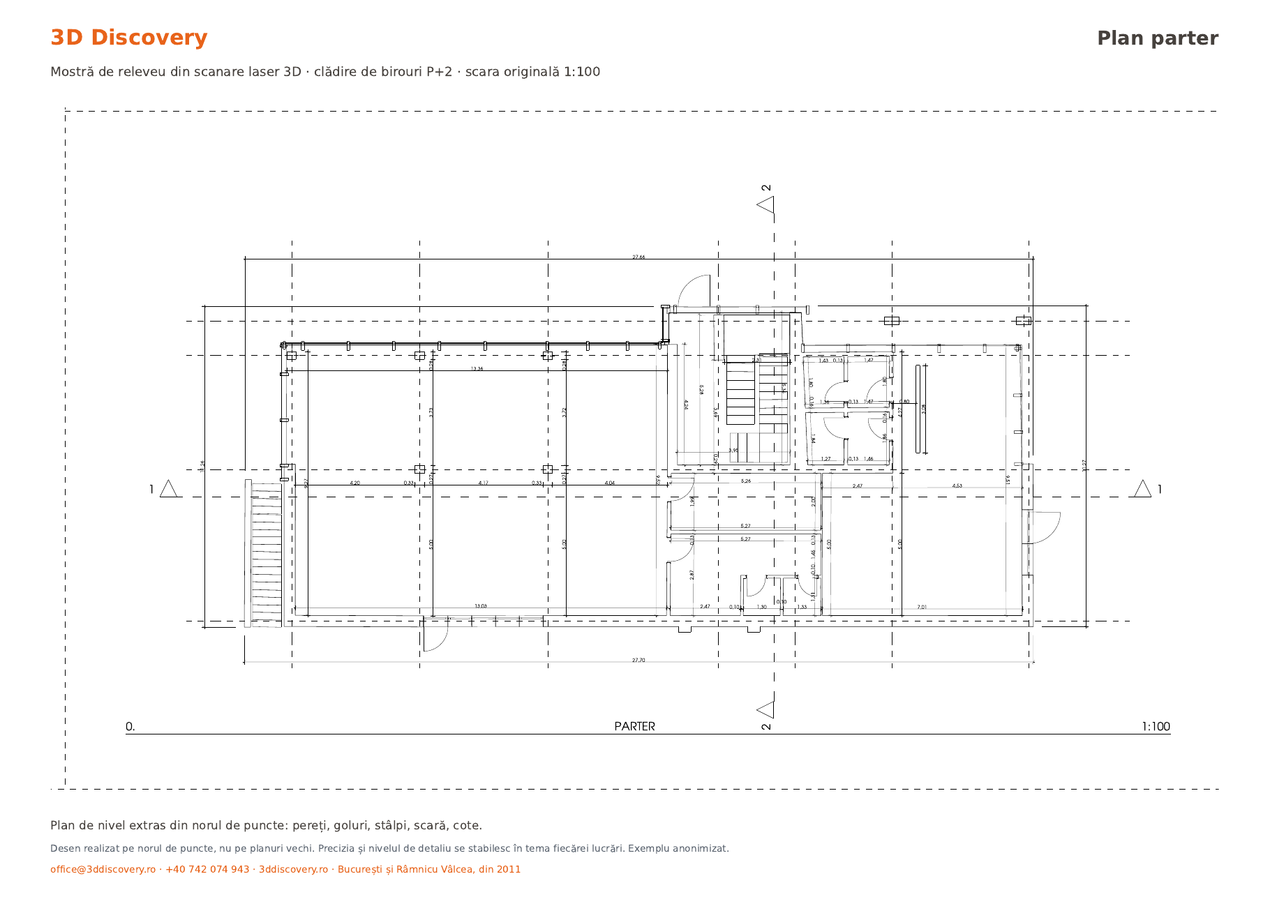
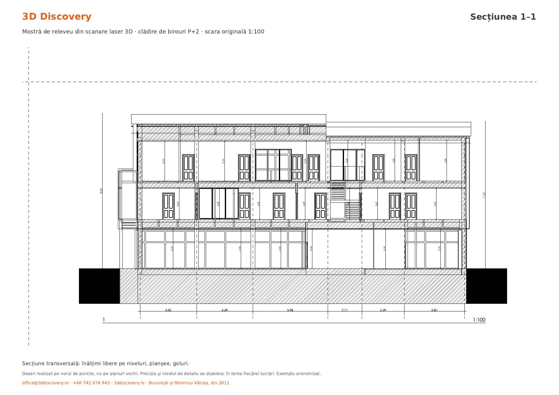
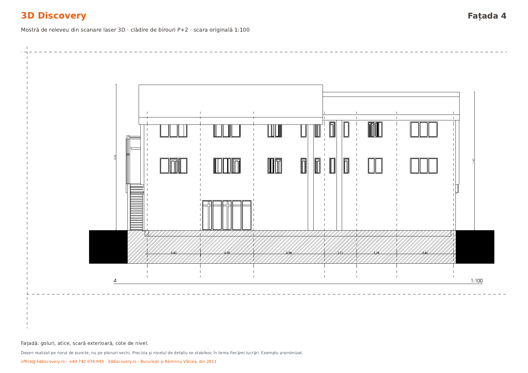
A plan, a section and an elevation from a real survey we produced, plus the ground floor plan as DXF so you can open it in your own software. See exactly what you get before you ask for a quote.
What you get
- A PDF with 3 A3 sheets: ground floor plan, section 1–1 and elevation 4, at the original 1:100 scale. The sheet labels are in Romanian.
- An editable DXF of the ground floor plan, in millimetres.
- A three-storey office building, drawn on the point cloud rather than from old drawings. Anonymised example.
Accuracy and level of detail are not the same on every job: we agree them in the brief, based on what the designer needs to receive. See also how the architect, the structural engineer and MEP use the same point cloud.
Get the sample
Leave your name, email and profession. The download links appear right after you submit.
We only use your details to reply to you. See our privacy policy (in Romanian).