
Zamfira Manor, Prahova — 3D scanning for documentation and restoration
A late 18th-century manor house linked to the history of Zamfira Monastery. A building with many stories and few measurements: one day on site with a Riegl VZ-400i, a georeferenced point cloud, 3D model, sections and elevations.
In short
- Building: historic manor house, c. 1780, Prahova County
- Equipment: Riegl VZ-400i terrestrial laser scanner
- On site: 1 day, interior and exterior
- Deliverables: georeferenced point cloud, 3D model, plans, sections, elevations
- Purpose: documentation, restoration and conservation
The situation
Documentation and any restoration work needed the real geometry of the building: walls, openings, floors and roof as they are today, not as they were once drawn. Old buildings do not follow their drawings; manor houses even less so.
What we did
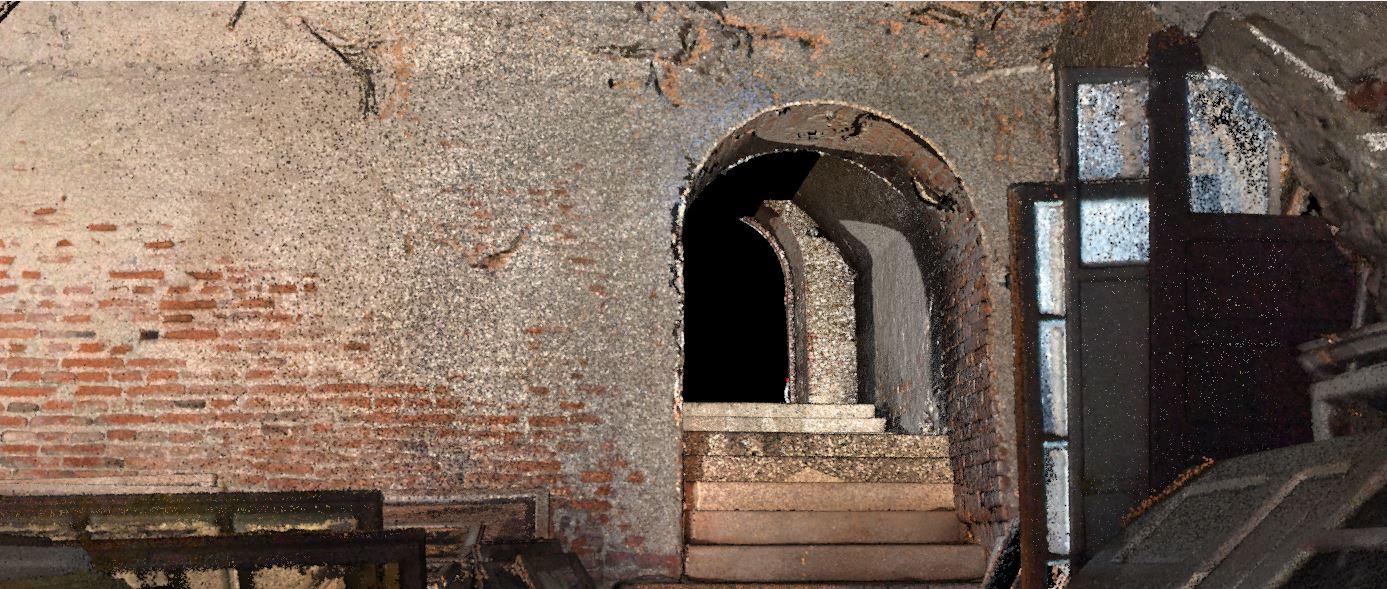
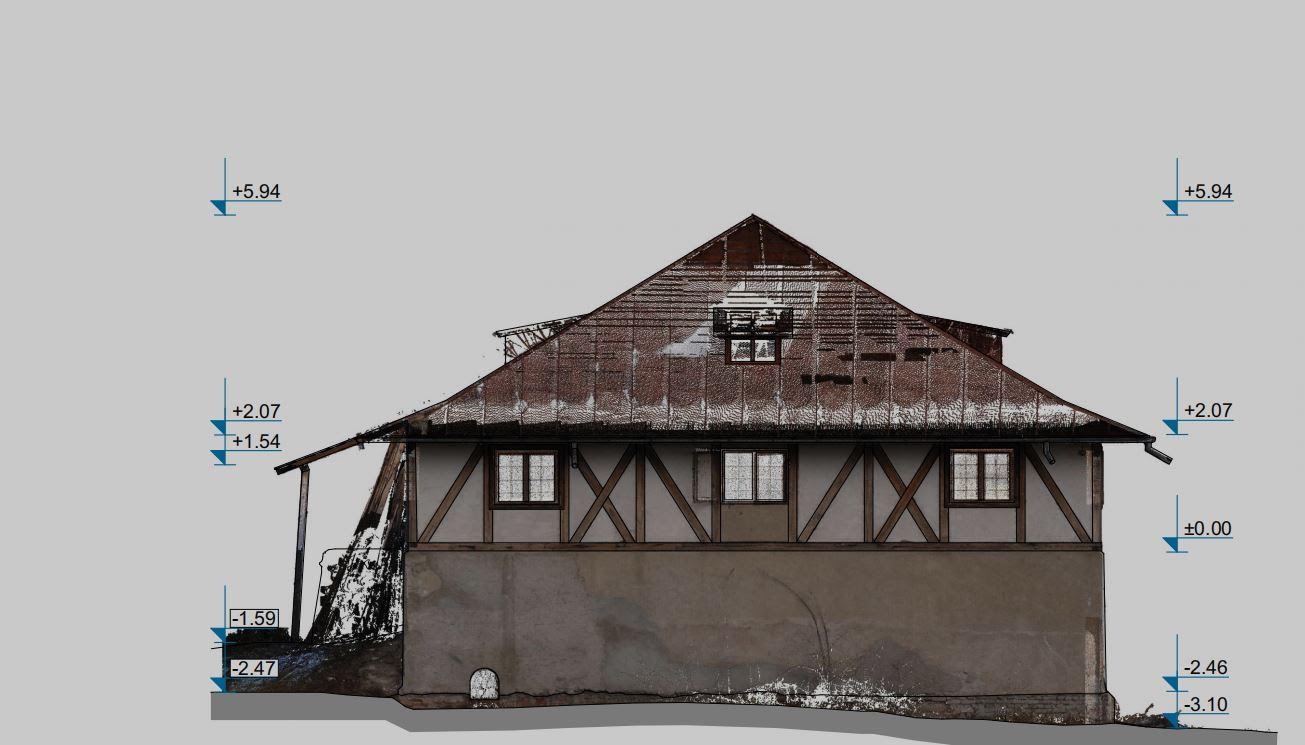
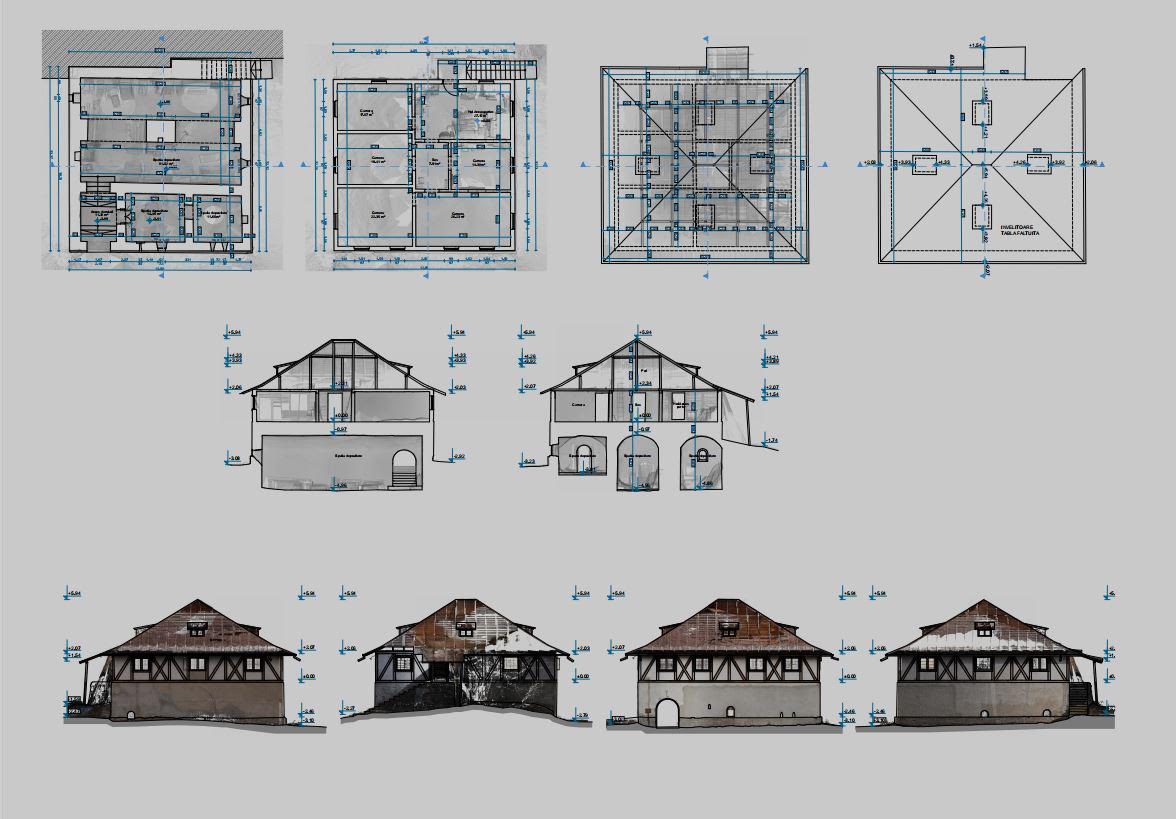
One day on site with the Riegl VZ-400i scanner, inside and out. The point cloud was registered and georeferenced, then our architects extracted the plans, sections and elevations and built the 3D model of the building.
In one day on site you get what a tape will not give you in two weeks: how elements relate, not just lengths. Deformations show up in the sections without having to look for them.
What it is used for
The sections and elevations are the base the conservation architect works on. They do not replace his interpretation: they give him the correct geometry before he interprets. For approvals, measured documentation is what stands up to questions.
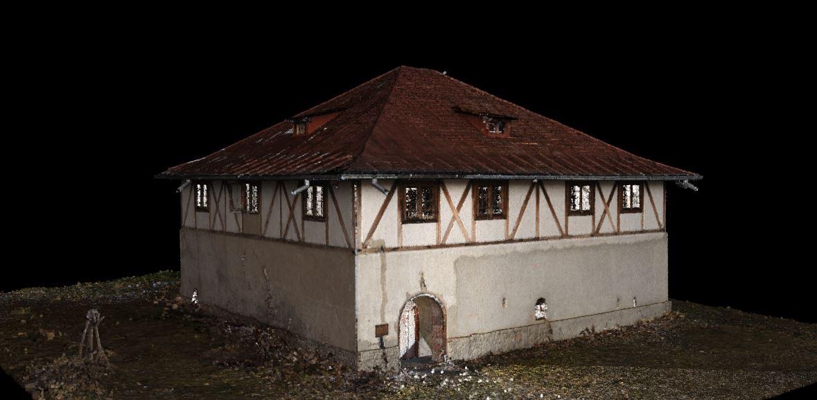
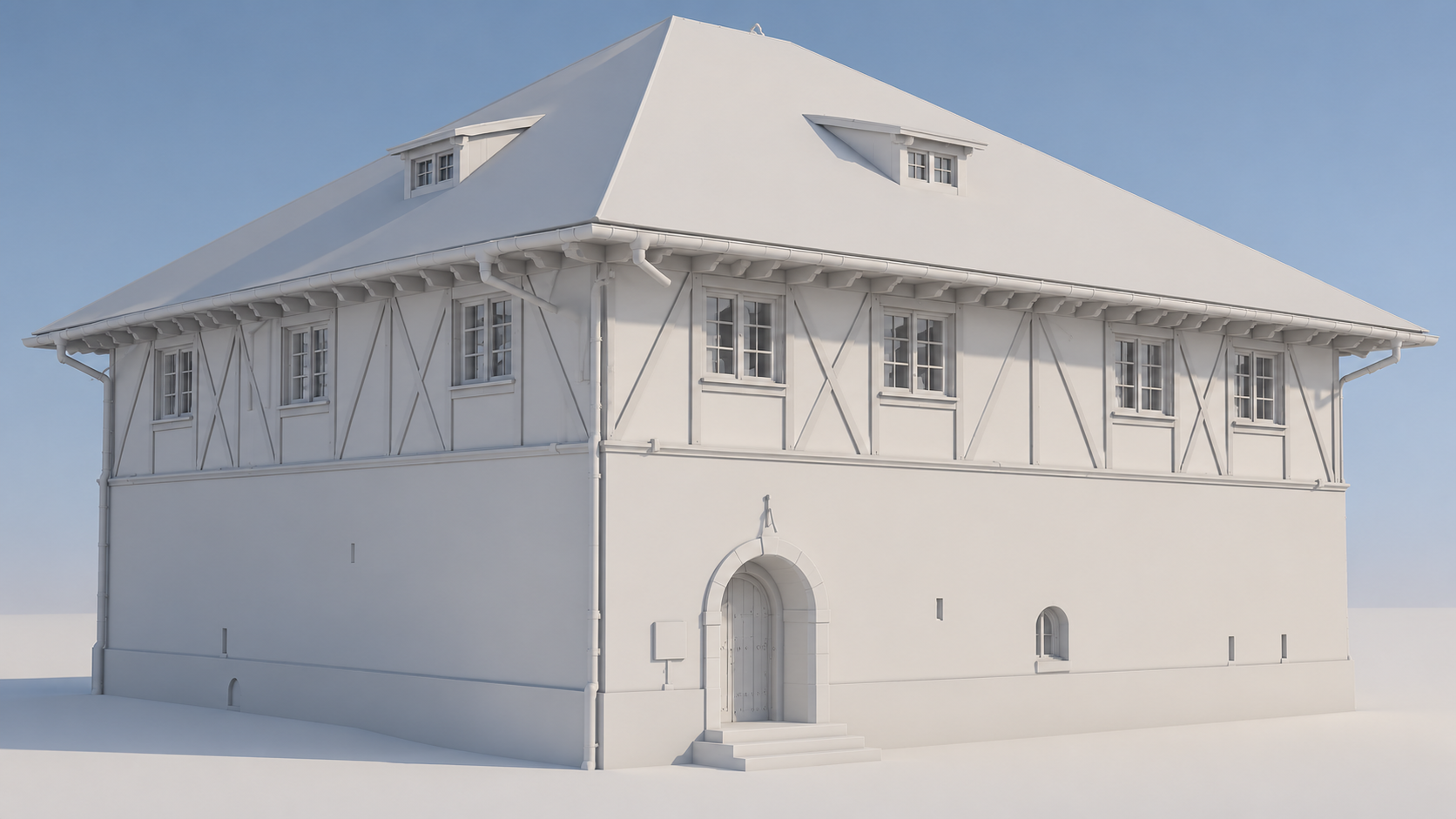
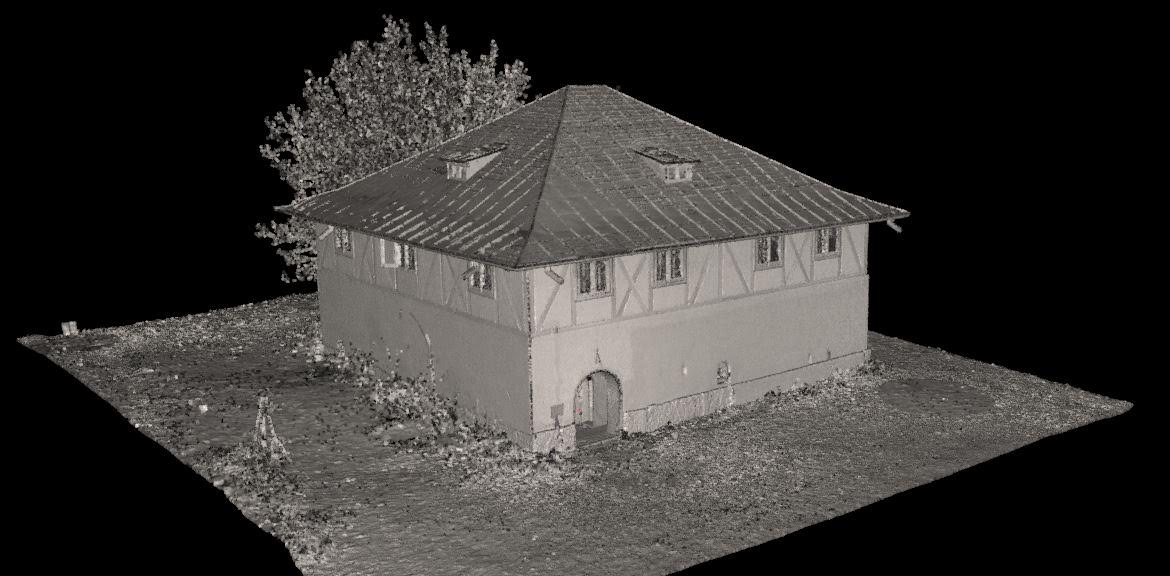
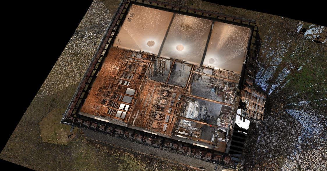
The point cloud and the model play complementary roles: the first keeps the captured data, the second organises the geometry into volumes, elevations, openings and roof, at the level of detail agreed for the documentation.
Read on the blog: from laser scanning to measured survey and 3D model →
Project gallery
Point cloud, 3D model and survey drawings. Click an image to enlarge.
Frequently asked questions
How long did the 3D scan of Zamfira Manor take?
One day on site, inside and out, with a Riegl VZ-400i terrestrial laser scanner.
What deliverables come out of the scan?
A registered and georeferenced point cloud, a 3D model, and plans, sections and elevations extracted for documentation.
Why laser scanning for a historic manor house?
Old buildings do not follow their drawings. The scan records how elements relate and the existing deformations, which show up directly in the sections, without approximate measurements.
Does scanning replace the conservation architect's expertise?
No. The measured documentation gives them the correct geometry; interpreting it and deciding on interventions remain with the specialists on the project.
Have a historic building to document?
Send us a few photos, the location and the approximate floor area. Within 24 working hours we tell you how we would document it, what we deliver and what it costs. Indicative ranges on the pricing page.
Describe your project →