
Ploiești Cathedral.
Fully scanned in one day.
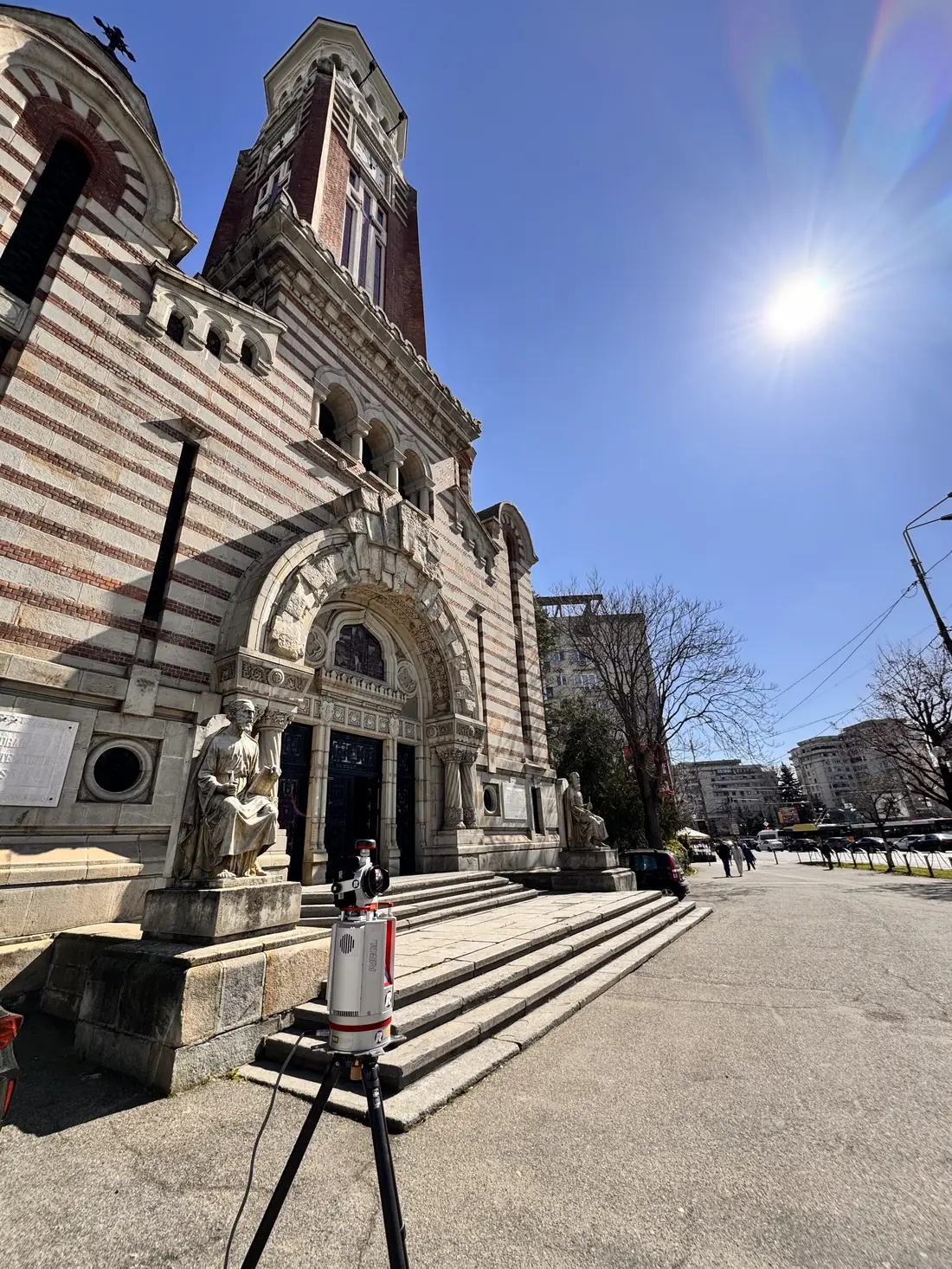
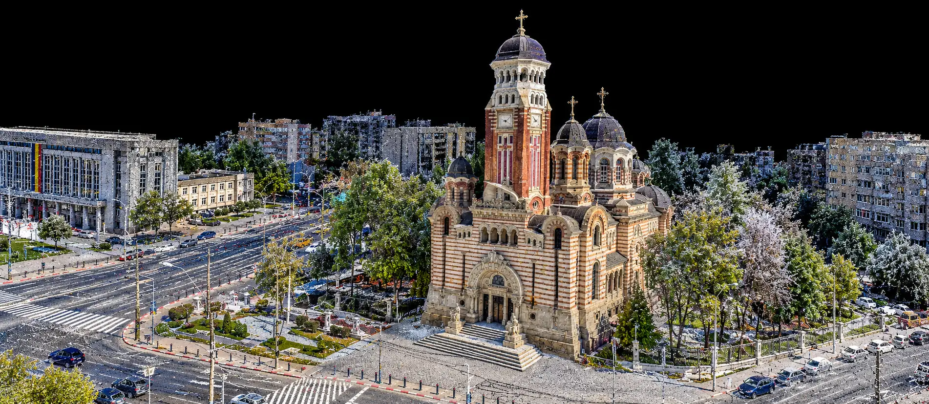
St. John the Baptist Cathedral, opposite the Administrative Palace: exterior, interior and bell tower documented by 3D laser scanning as the base for the restoration project.
A historic monument in the heart of the city.
St. John the Baptist Cathedral is a listed historic monument (LMI code PH-II-m-A-16261) and one of Ploiești’s landmark buildings. The church dates from 1840–1842, and the bell tower, built between 1923 and 1939 to a design by architect Toma T. Socolescu, was conceived as a memorial to the Prahova heroes of the First World War.
The restoration project needed the real geometry of the whole ensemble: the church volumes, the spires, the bell tower, the façade ornament and the painted interiors, all in a single coordinate system.
Exterior, interior and bell tower. In a single day.
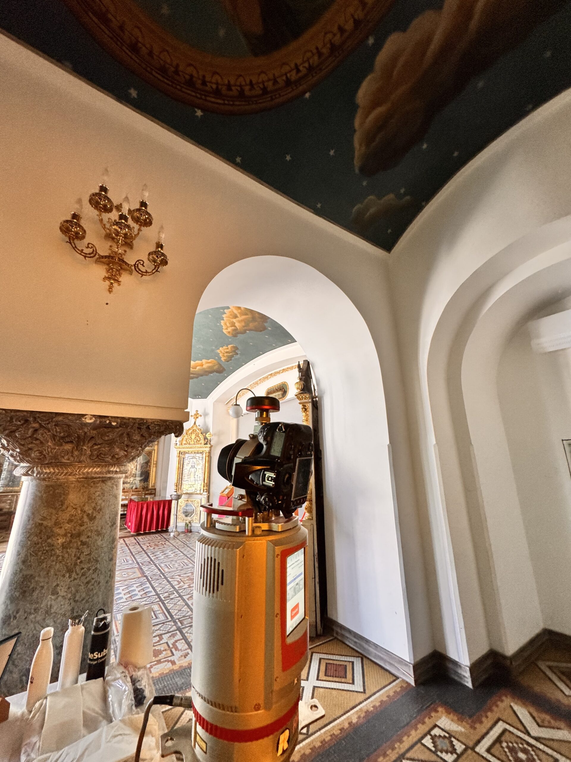
We worked with a Riegl VZ-400i laser scanner with a scanner-mounted camera to colour the point cloud. The stations covered the façades, the interior with its painted vaults and the bell tower, registered together and tied into the topographic survey of the site.
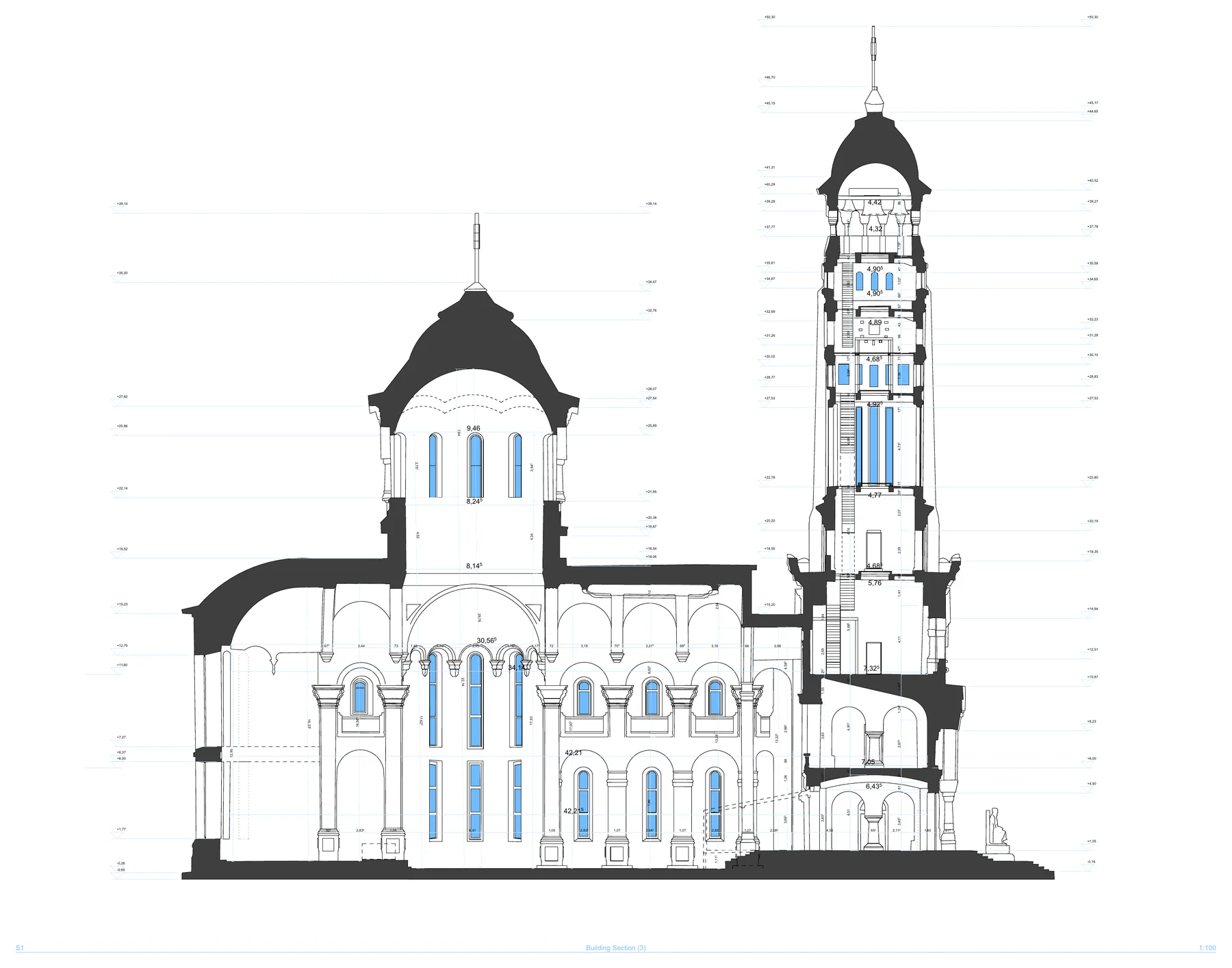
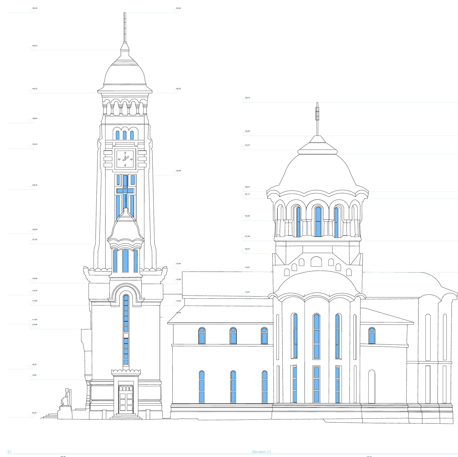
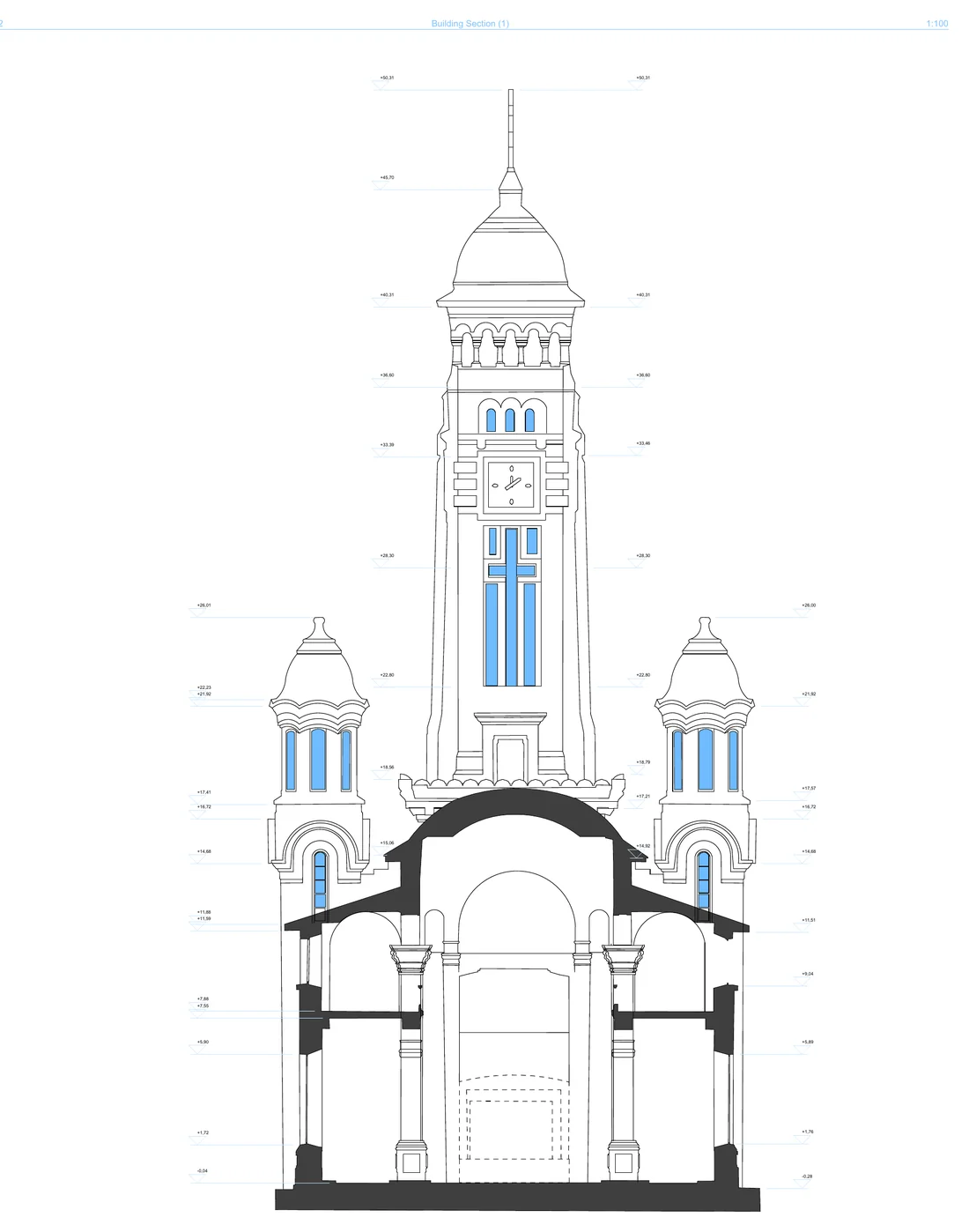
From the unified point cloud we extracted the 2D plans, elevations and sections, and the topographic plan placed the monument in its urban context, between the boulevards and the surrounding street fronts.
Project sheet
| Subject | St. John the Baptist Cathedral, Ploiești |
|---|---|
| Status | Historic monument, LMI code PH-II-m-A-16261 |
| Purpose | Documentation for restoration |
| Capture | Full 3D laser scan in one day on site |
| Equipment | Riegl VZ-400i with camera |
| Deliverables | 2D plans, elevations, sections, topographic plan |
| Formats | DWG, PDF |
From the point cloud to restoration drawings.
Elevations and sections extracted directly from the scan, with ornament and openings in their real position.
Why it matters for restoration
A monument this complex cannot be surveyed correctly with a tape: great heights, spires, vaults, ornament and out-of-plumb deviations that old drawings do not show. Laser scanning captures it all in a single site campaign.
The designer works on the real geometry, and the point cloud remains the reference for checks, additional details and monitoring the works.
For the contractor, the same scan can deliver orthophotos and measured areas for bidding and decay mapping. Details on the page 3D scanning for restoration contractors.
Frequently asked questions
How long did scanning the cathedral take?
One day on site for the full scan: exterior, interior and bell tower.
What was delivered?
2D plans, elevations, sections and a topographic plan, in DWG and PDF.
How are high areas such as the spires and bell tower measured?
By long-range laser scanning from several ground stations and from inside, registered into a single point cloud.
Can additional details be extracted later?
Yes. New sections or details can be extracted from the point cloud at any time, without another site visit.
Preparing the restoration of a monument?
Tell us about the building and what you need to hand to the designer. Indicative ranges on the pricing page.
Discuss the project →