
3D scanning for buildings.
Drawn by architects.
We measure the existing building by laser scanning and hand it over as plans, sections, elevations and a BIM model, produced by our architects, not by operators. In ArchiCAD, Revit, IFC or DWG, at the level of detail your brief requires.
Since 2011 · 400+ projects · Ploiești Cathedral · the Iași hall · the Giurgiu villa
You design on an existing building. The archive drawings are no longer what exists.
Re-partitioning, blocked openings, out-of-plumb walls, deformed floors, levels that no longer match. When the brief starts from old drawings or a spot survey, the differences show up late: at the assessment, at approval or on site.
Laser scanning records the visible geometry of the building in a single coordinate system. From it we draw exactly the items you need for the project, and dimensions not requested at first can be extracted later without another site visit, for elements captured well enough.
Deliverables for design, not raw files.
We agree the package with you, according to the project stage. The point cloud is not mandatory: some designers want it, others work only on drawings. We deliver it as a base for checking and completing the drawings.
| Floor plans | Walls, openings, doors and windows, stairs, dimensions and areas · DWG and PDF |
|---|---|
| Sections | Levels, clear heights, floor thicknesses, the relationship between levels · DWG and PDF |
| Elevations | Openings, profiles, decorative elements relevant to the brief · DWG and PDF |
| BIM model | ArchiCAD (native format, our main tool), Revit, IFC · LOD 200–300, according to the brief |
| Area schedule | By room and level, following the conventions agreed with the designer |
| Point cloud | E57, LAS or another format, in colour on request · optional, for checking and completing the drawings |
This is what we hand over.
Extracts from delivered projects. Click an image to enlarge.
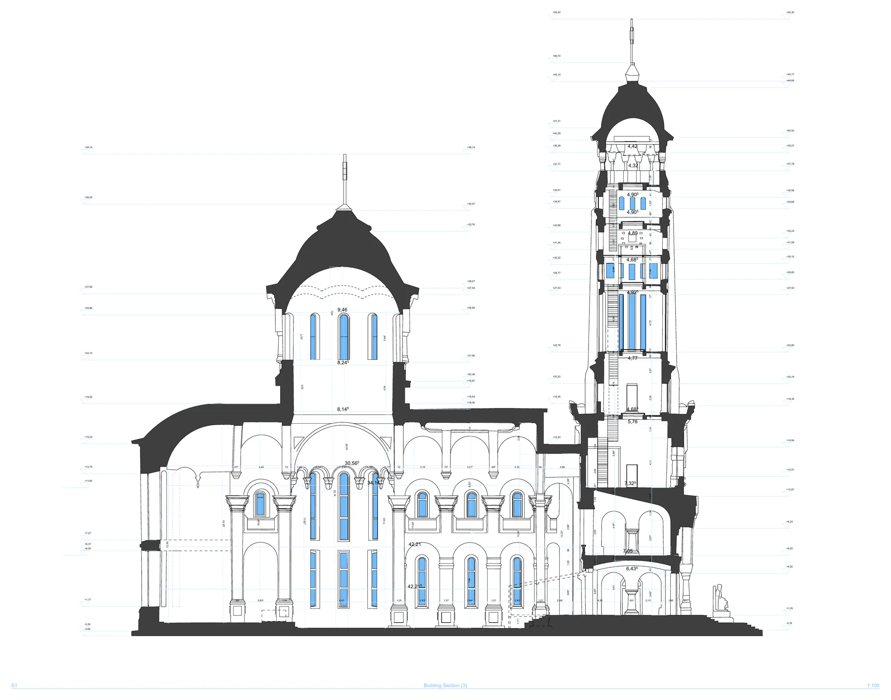
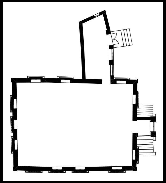
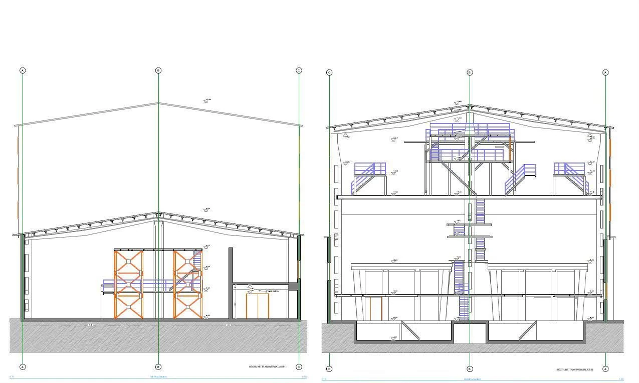
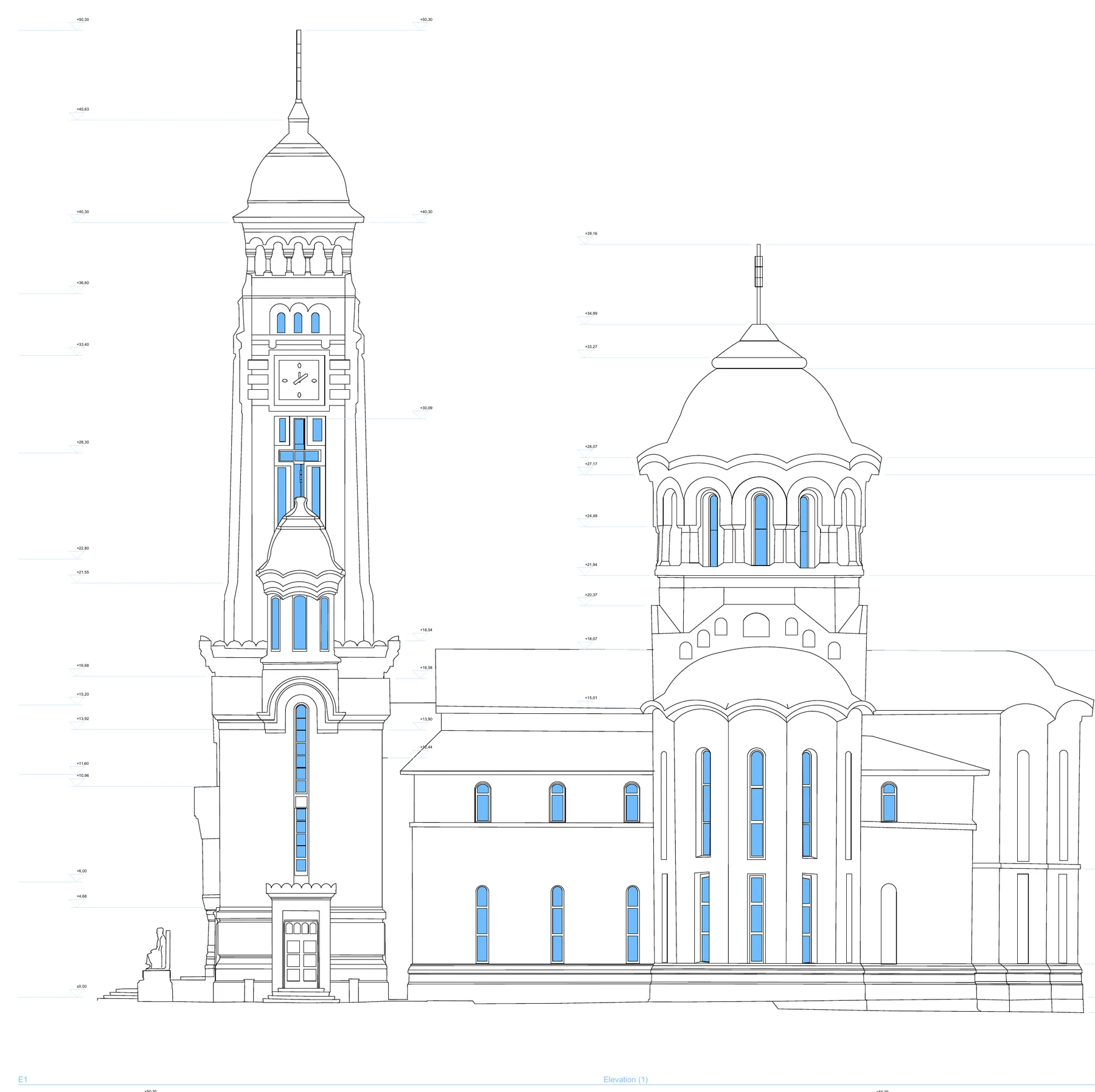
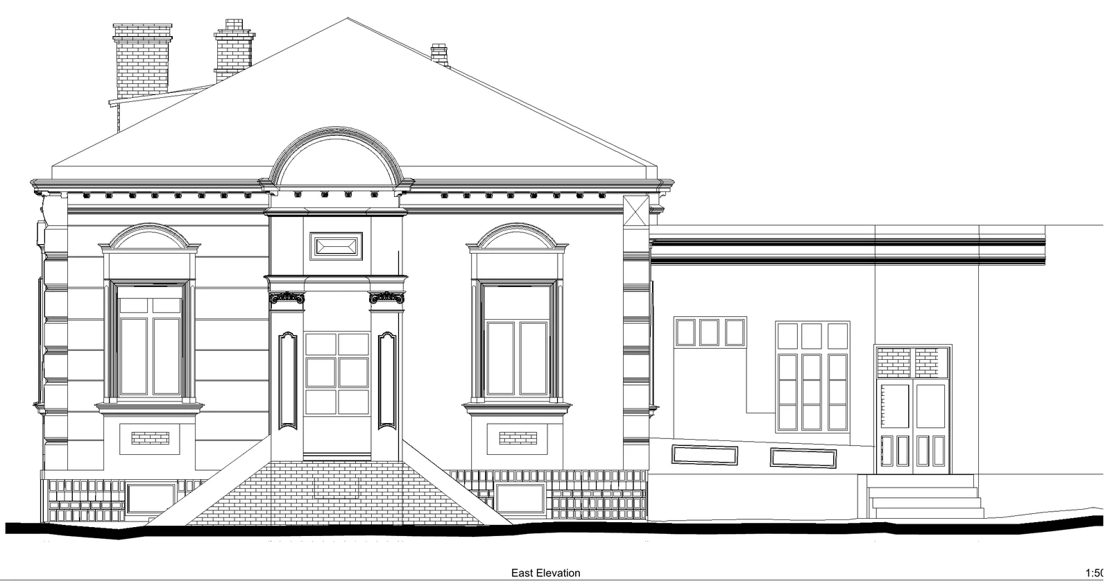
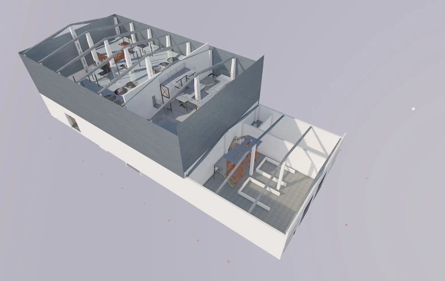
The full projects: Ploiești Cathedral, the Giurgiu villa, the Iași industrial hall.
Download the sample drawings (PDF, 8 pages, 1.2 MB) ↓
Ploiești Cathedral: 4 sections and 4 elevations, drawn in ArchiCAD on the point cloud. Vector, readable when zoomed. Presentation material.
The tolerance is set in the brief. The point cloud remains the reference.
We do not promise a universal accuracy. Accuracy and tolerances depend on the purpose of the work, site conditions and equipment (Riegl VZ-400i or Trimble TX8), so we agree them with you before measuring, together with the drawing scale and level of detail.
The drawings are made on the point cloud, not from site sketches. If you also receive the cloud, you can check the dimensions of captured elements directly in it or extract additional sections when the project needs them.
The limits are stated explicitly: hidden, inaccessible or furniture-covered areas are marked in the deliverable, and build-ups inside elements are not visible in the scan.
From brief to drawings.
Site scanning time and processing and drawing time are separate. Both depend on complexity: a hall with large spaces scans much faster than a historic building with many small rooms. We set the exact delivery date in the quote.
When scanning makes sense and when it does not.
A measured survey can also be done with conventional methods. The difference shows on large, irregular or much-altered buildings.
| Small building, regular geometry | Conventional measurements may be enough. We tell you from the start. |
|---|---|
| Large or multi-storey buildings | Scanning captures everything in one site campaign, in the same coordinate system. |
| Historic buildings, vaults, ornament | Irregular geometry and deformations show in the cloud and are not approximated. |
| Dimensions not requested at first | Extracted later from the data, without another site visit, if the element was captured well enough. |
| Buildings in use | Short time on site, with little impact on activity. |
You can also use the arguments above in your discussion with the client.
Each building type has its own questions.
Frequently asked questions
Do you work in ArchiCAD?
Yes, ArchiCAD is the format we work in most often. We also deliver in Revit, IFC and DWG, depending on what your design team uses.
Do I also receive the point cloud?
If you want it, yes: in E57, LAS or another agreed format, in colour on request. It is not mandatory: many designers work only on drawings and the model. The cloud is useful for checking dimensions and adding captured elements later.
How long does it take?
Site scanning and drawing are calculated separately. On site, as an example, we scan 2,000–4,000 m² a day, depending on complexity; an ordinary building usually means 1–3 days. Processing and drawing typically take 7–10 days from scanning for a 1,000–5,000 m² building. We set the exact delivery date in the quote.
How accurate are the plans?
Accuracy and tolerances are set according to the purpose of the work, site conditions and equipment, together with the scale and level of detail. We agree them with you before measuring.
When does scanning not make sense?
For a small building with regular geometry, conventional measurements may be enough. We tell you before quoting.
What should I send you for a quote?
The address, approximate floor area, number of floors, project stage and the deliverables you need. Existing drawings, if you have them, help us estimate more precisely.
Tell us what decision you need to make about the building.
We reply within 24 working hours. We agree what to measure, what to deliver, the deadline and the quote once the project details are clear. Indicative ranges on the pricing page.