
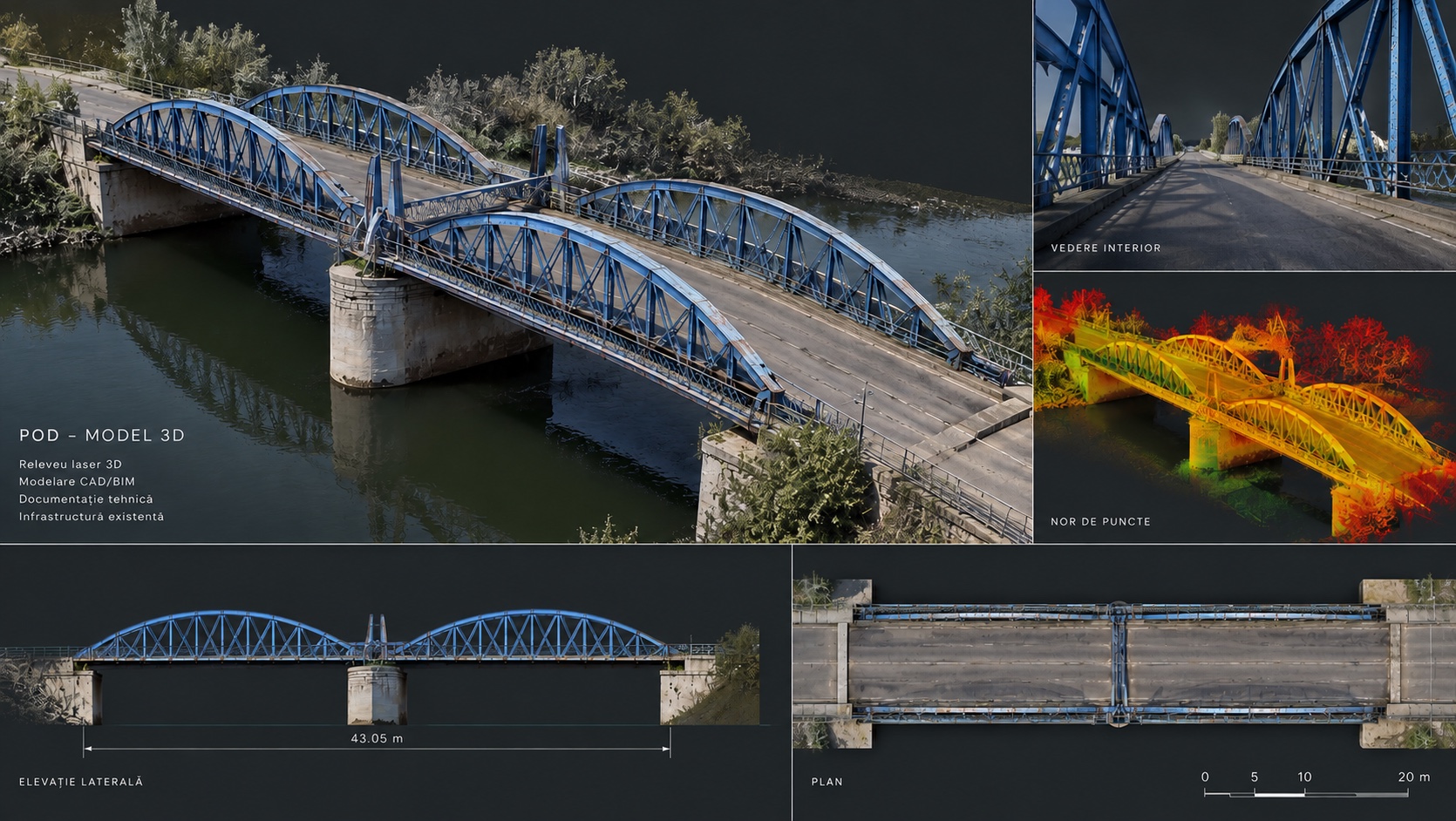
How do you document a historic bridge without reducing a complex structure to a few hand-measured dimensions? At Bizetz Bridge in Giurgiu, the answer was to build a common geometric base: 3D laser scanning, survey control and deliverables extracted from the same point cloud.
Why Bizetz Bridge matters
The bridge crosses the St. George canal and was built as part of the development of the port of Giurgiu. It was opened on 9 November 1905, with the involvement of engineers Ion Ionescu-Bizetz and Anghel Saligny.
The historic study published for the restoration project describes it as an innovative achievement for its time: a road and rail bridge curved in plan, with early use in Romania of a reinforced-concrete compressed-air caisson. The monument is on the List of Historic Monuments under code GR‑II‑m‑B‑14894.
What had to be measured
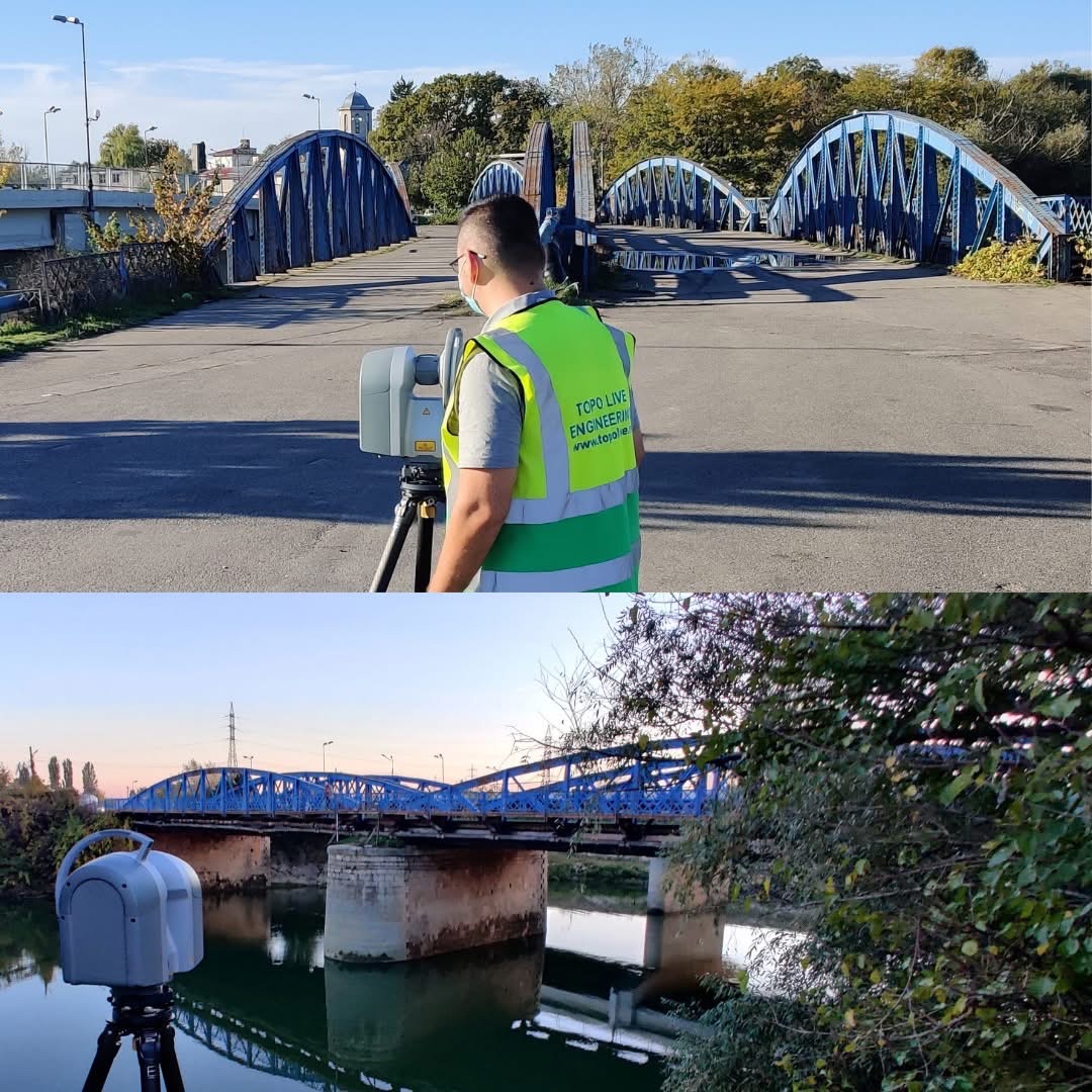
The steel arches, the deck, the bracing, the piers, the abutments and the level differences form a single system. Because of the water and limited access beneath the structure, isolated measurements could not offer the same coherence as a unified point cloud.
The workflow
What the restoration designer receives
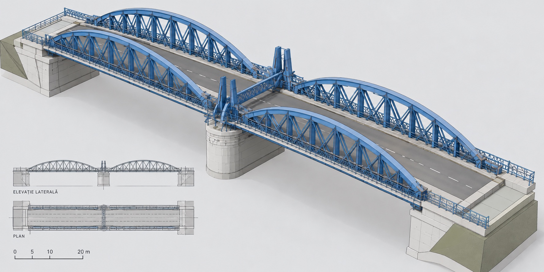
Instead of unconnected files, the design team receives a single geometric reference. It makes it possible to check levels, follow the relationships between members, compare with historic documents and reduce return visits.
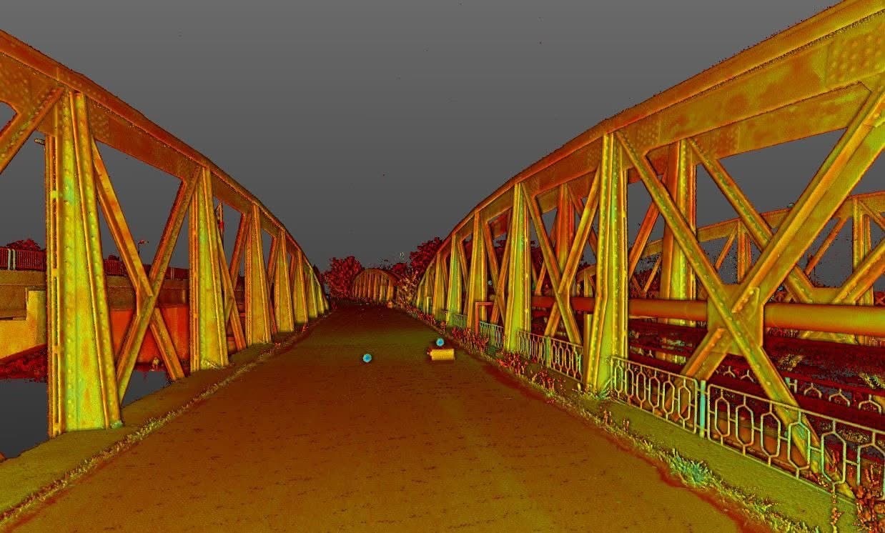
For existing structures, the value of 3D scanning is not the spectacular image of the point cloud. The value is the certainty that the plan, the section and the model describe the same reality.
Bizetz Bridge as a case study
The project shows why historic infrastructure needs the same digital discipline as major contemporary projects. An old structure should not be simplified to fit a survey; the documentation method must be complete enough for the structure.
See the technical gallery, project sheet and deliverables on the dedicated page: Bizetz Bridge — full case study.
Historic sources
Giurgiu County Directorate for Culture · Bizetz Bridge — historic study, 2021.
Have a bridge, underpass or complex structure?
Send us the location and the purpose of the documentation. We reply within 24 working hours. We agree the capture method, deliverables, schedule and quote once the project details are clear. Talk to the 3D Discovery team →