
Bizetz Bridge, Giurgiu — 3D scanning for documentation and restoration
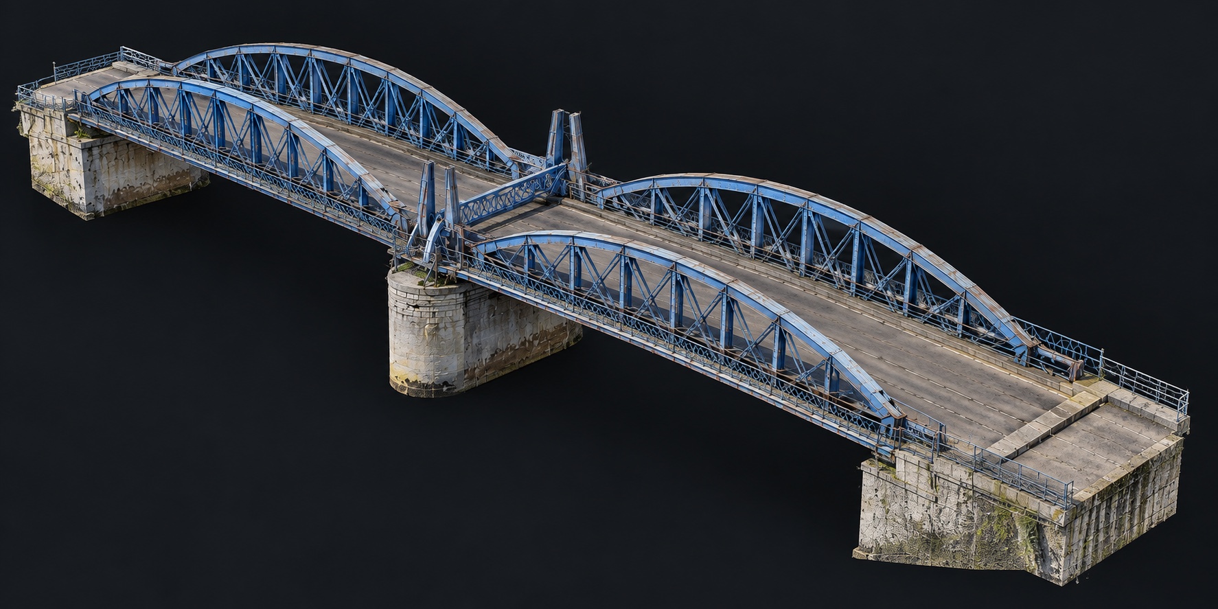
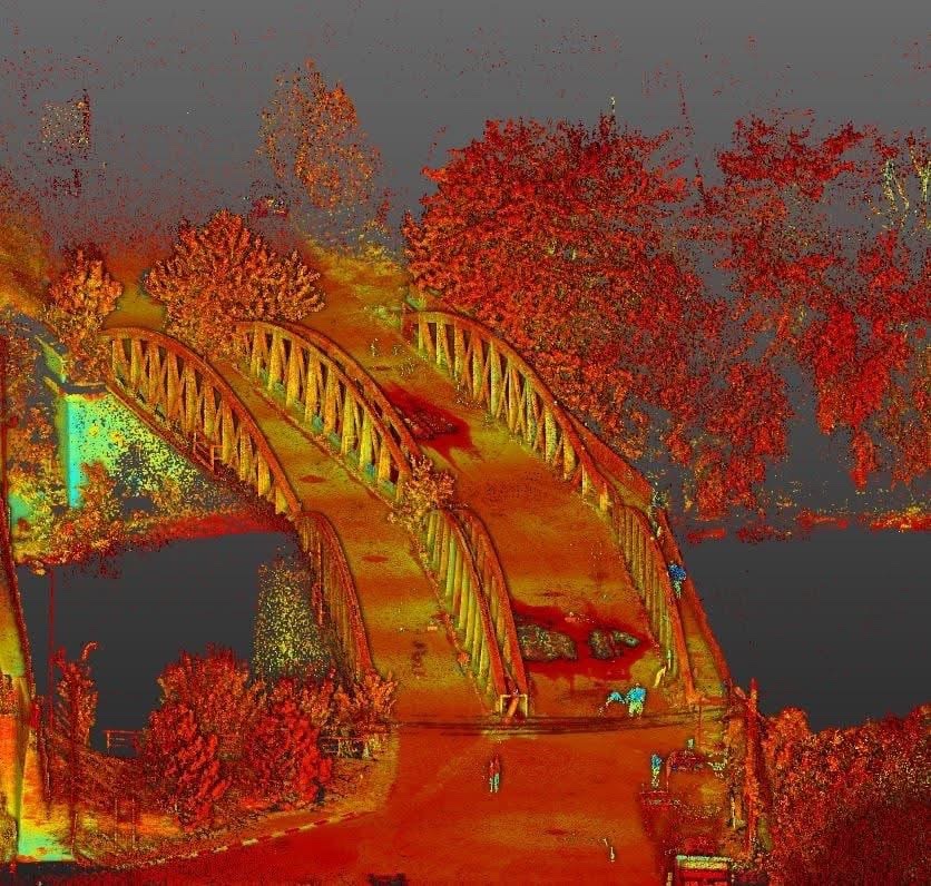
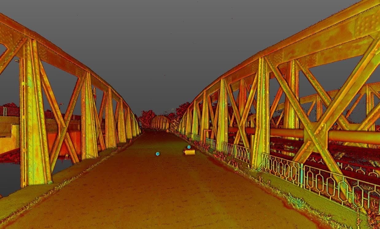
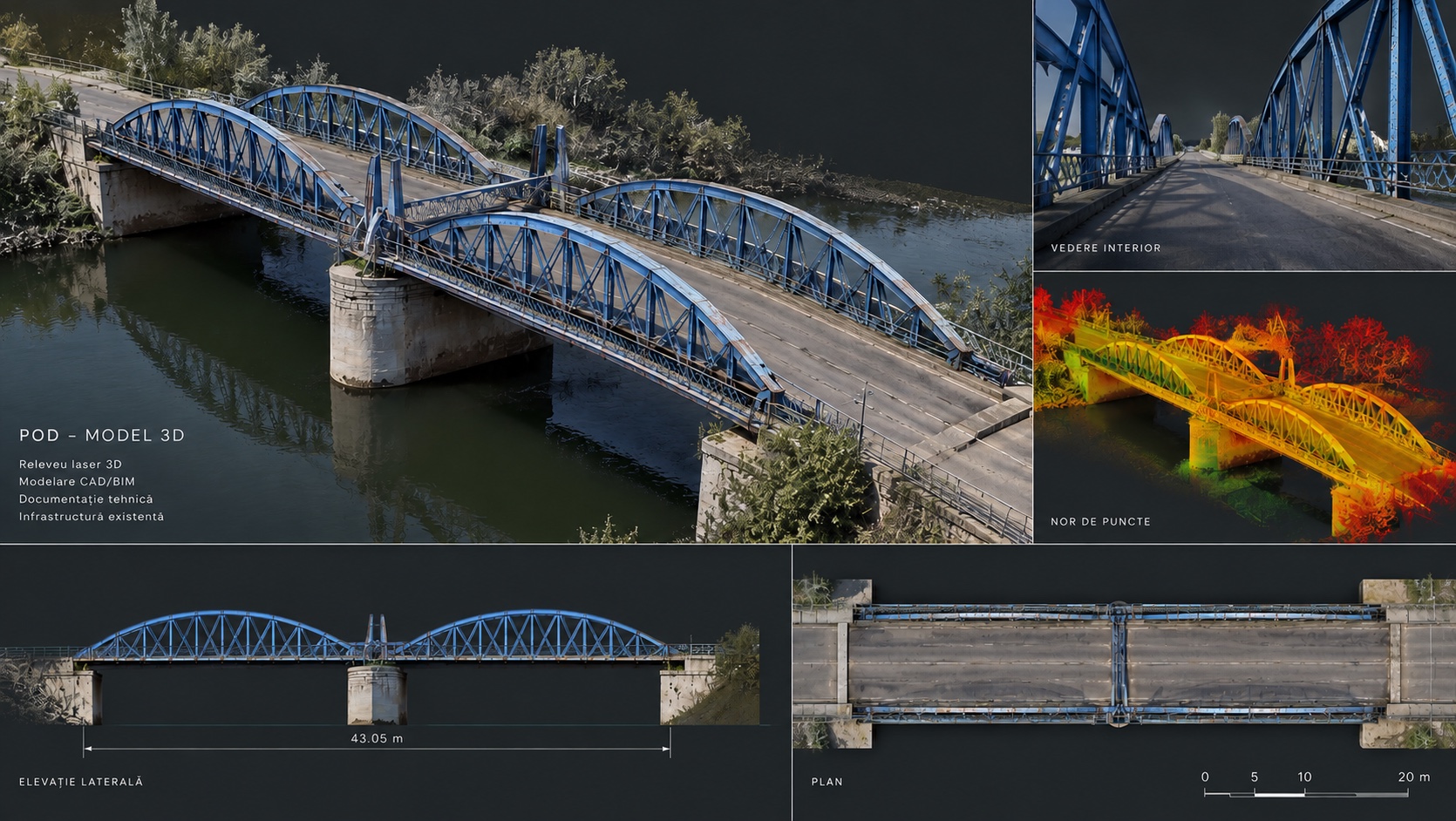
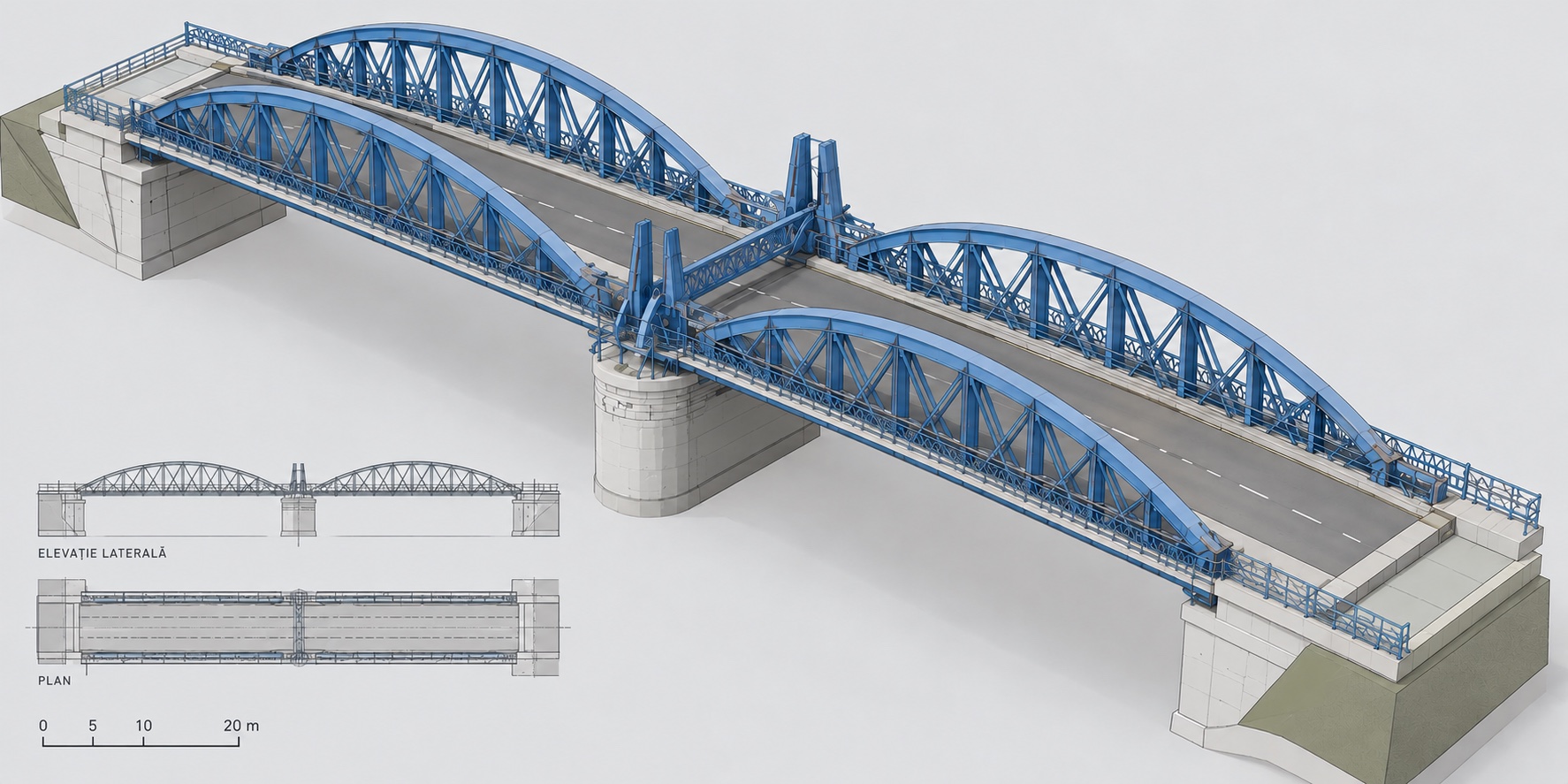
A 1905 monument of Romanian engineering turned into a coherent dataset: point cloud, topographic plan, sections, elevations and 3D model.
In short
- Subject: historic steel road and rail bridge, St. George canal, Giurgiu
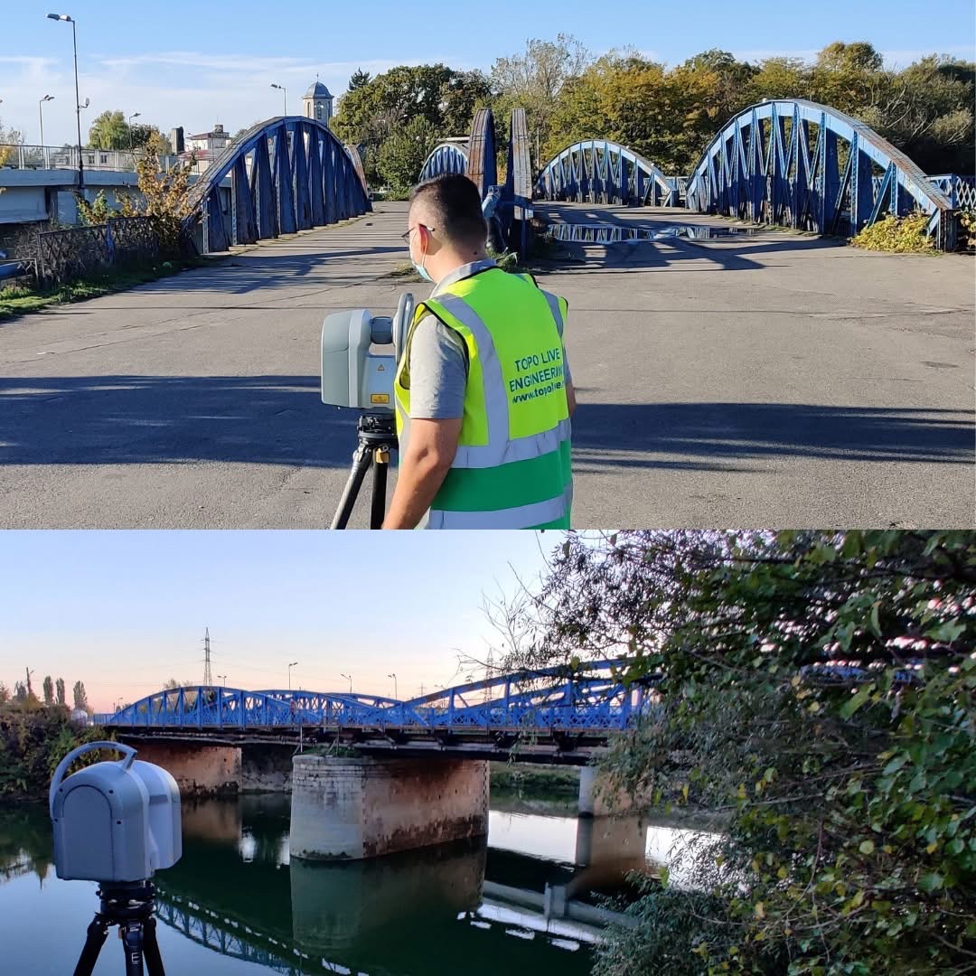
- Equipment: Trimble TX8 laser scanner, GNSS control
- On site: 2 days
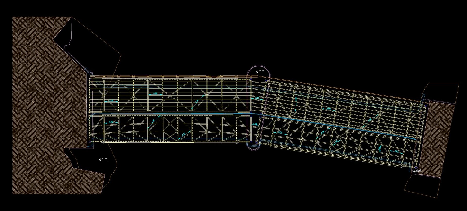
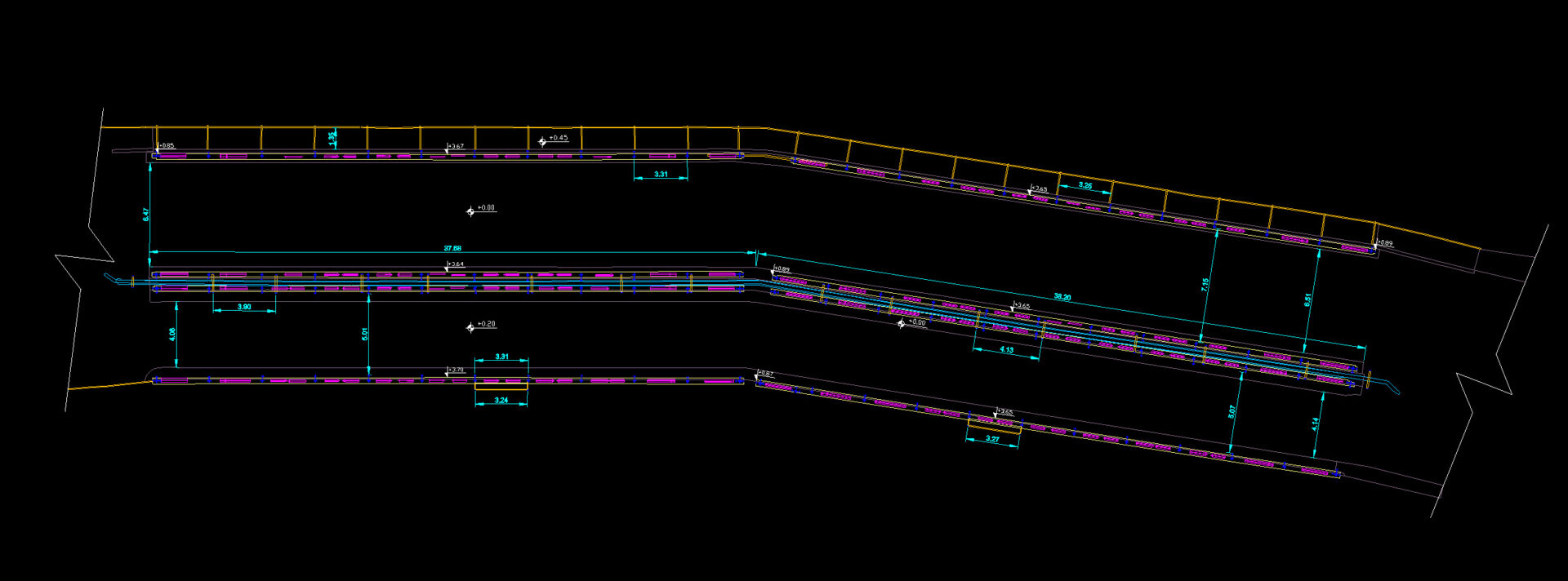
- Deliverables: georeferenced point cloud, topographic plan, structural plan, elevations, sections, 3D model
- Purpose: documentation, restoration design, digital archiving
A piece of engineering history
Bizetz Bridge crosses the St. George canal and links the town with the port area. It was opened on 9 November 1905, with the involvement of engineers Ion Ionescu-Bizetz and Anghel Saligny. The monument's historic study presents it as an innovative achievement for its time: a road and rail bridge curved in plan, with early use of a reinforced-concrete compressed-air caisson for its foundations.
Today the bridge is on the List of Historic Monuments under code GR-II-m-B-14894: utilitarian infrastructure and, at the same time, a physical record of a decisive stage in Romanian engineering.
The documentation challenge
The structure has two main spans, a non-aligned geometry and many repeated steel members. Access under the deck and the proximity of water limit conventional measurement, and any incomplete survey passes uncertainty on to the restoration designer.
The objective was a single geometric base, measurable and reusable for analysis, design and archiving.
From the site to the digital model
Over two days we set up Trimble TX8 scan stations on the deck, on the banks and in the accessible areas near the piers. The data was tied together by GNSS survey control and merged into a single georeferenced point cloud. From this base we extracted the topographic plan, structural plan, elevations, sections and 3D model.
The result for the designer
A single geometric reference for every discipline. The model and drawings make it possible to check levels, relationships between members and differences from the historic documents, reducing return visits and decisions taken on approximations.
Historic sources: Giurgiu County Directorate for Culture — List of Historic Monuments · Bizetz Bridge — historic study, 2021.
Project gallery
From the site to a point cloud, then to a 3D model and drawings. Click an image to enlarge.
Frequently asked questions
How long did the 3D scan of Bizetz Bridge take?
Two days on site, with Trimble TX8 scan stations on the deck, on the banks and near the piers, tied together by GNSS survey control.
What deliverables resulted?
A georeferenced point cloud, topographic plan, structural plan, elevations, sections and 3D model.
Why laser scanning for a historic steel bridge?
The non-aligned geometry, the repeated steel members, limited access under the deck and the proximity of water make conventional measurement incomplete. Scanning provides a single geometric base for every discipline.
Is Bizetz Bridge a listed historic monument?
Yes. The bridge, opened in 1905, is on the List of Historic Monuments under code GR-II-m-B-14894.
Need to document a bridge or a complex structure?
Send us the location and the purpose of the project. We reply within 24 working hours with the capture method, deliverables and proposed schedule. Indicative ranges on the pricing page.
Describe your project →