
In short: when a building sits on sloping ground, next to water or between wooded slopes, the building and the terrain must be measured in the same campaign and in the same coordinate system. 3D laser scanning captures the building’s volume, and the topographic survey frames the terrain, the access routes and the watercourse, so the designer receives a single working base. At Spring 24 in Băile Olănești, the building and the terrain were documented in a single point cloud with a Riegl VZ-400i scanner.
Documenting a spa heritage site does not just mean measuring a building. At Spring 24 in Băile Olănești, the building, the sloping ground, the watercourse and the access routes form a single system. 3D Discovery captured them in a common digital base, ready for conservation, restoration and design.
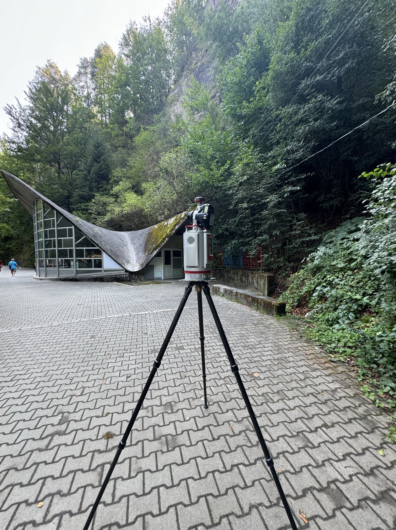
Why is Spring 24 difficult to document?
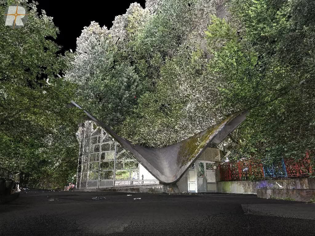
The architecture, with its thin roof shell and curved geometry, sits in a difficult natural setting: wooded slopes, level differences, dense vegetation and limited access. Conventional methods can produce fragmented measurements, taken separately for the building and the terrain. Any mismatch between these datasets is then carried into the design.
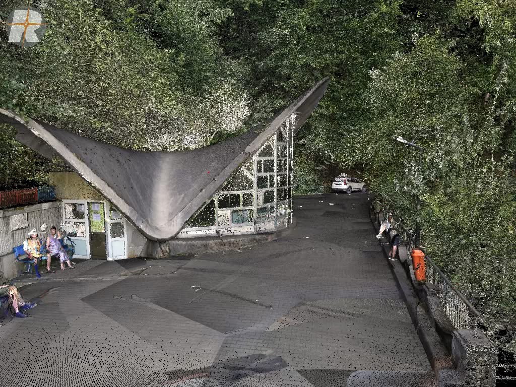
3D laser scanning reduces this fragmentation. Each scanner position records the visible geometry at high density, and the data is merged into a georeferenced point cloud. The building and the site can then be analysed in the same coordinate system.
Site documentation
The 3D Discovery team carried out the capture in one day, using the Riegl VZ-400i laser scanner and GNSS equipment. The Spring 24 structure, the accessible interior spaces, the platforms, the access routes and the immediately surrounding terrain were documented.
- Location: Băile Olănești, Vâlcea County
- Site type: mineral spring and spa heritage structure
- Capture duration: one day
- Technology: Riegl VZ-400i laser scanning and GNSS
- Deliverables: point cloud, 3D model, sections, elevations and topographic plan
- Use: documentation, conservation and restoration
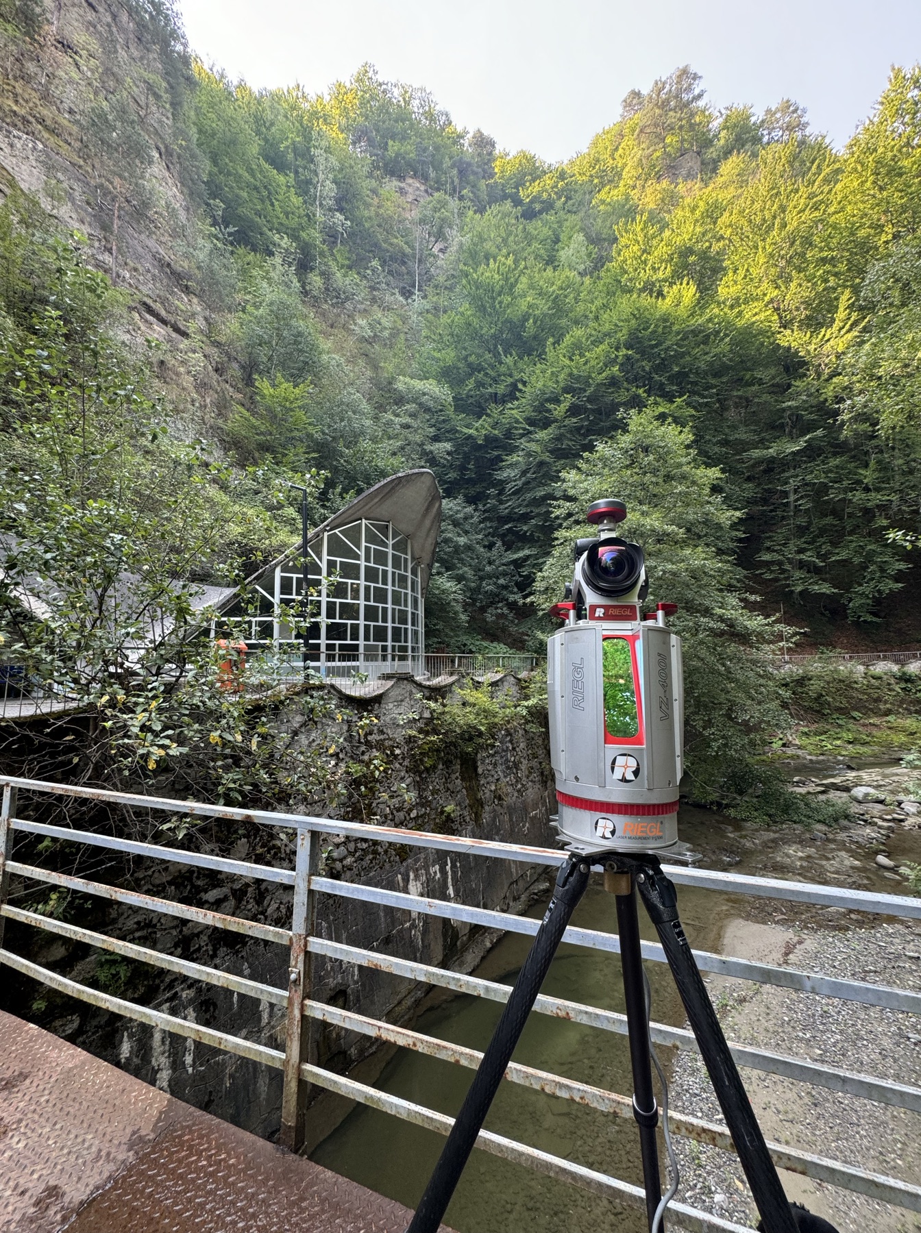
From the point cloud to the 3D model
The point cloud keeps the real shape of the structure, including the curvature of the roof, the relationship between structural elements, glazing and the external platforms. It is checked, cleaned and turned into documentation usable by architects, engineers and heritage specialists.
The 3D model is not a visual reinterpretation of the building. It is built on the measured geometry and allows plans, sections and elevations to be extracted consistently. For a free form, hard to describe with spot measurements, this continuity is essential.
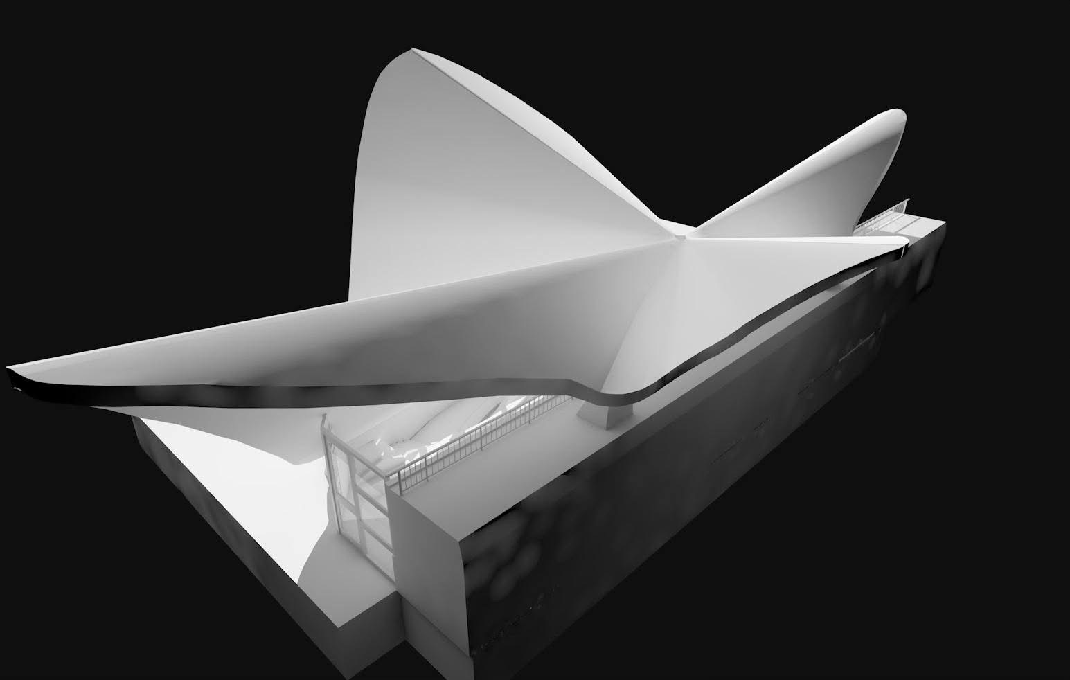
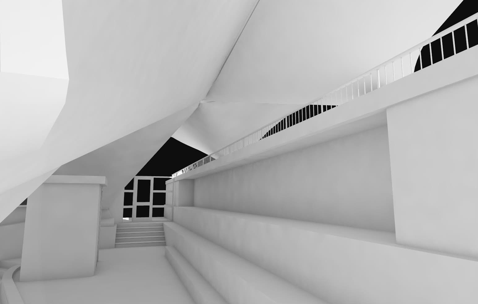
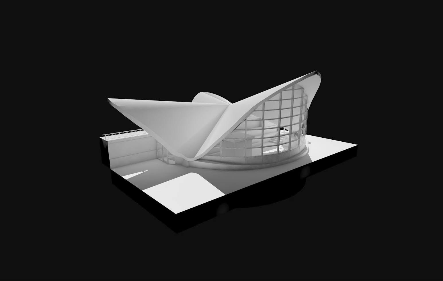
The building and the terrain must be documented together
On a spa site, the relationship with the terrain is not a secondary detail. Access, level differences, retaining walls, vegetation and the watercourse influence the technical solutions. The topographic plan and the building model provide a common reference, avoiding the approximate overlaying of independent surveys.
What value does 3D documentation produce?
The result is a technical base that can be checked before design. Specialists can consult the existing geometry, extract dimensions and coordinate interventions without separately rebuilding the reality on site. The risk of return visits for additional measurements falls, and decisions can be backed by data.
3D Discovery projects are configured modularly. Only the information the objective needs is delivered: point cloud, 2D plans, 3D model, topography or a combination.
Frequently asked questions
Does 3D scanning affect the building or the spring?
No. Laser scanning is a contactless capture method, suitable for documenting the visible geometry of sensitive sites.
Can the terrain be measured in the same campaign?
Yes. Scan data and GNSS measurements can be integrated into a common system, so the structure and the site are coordinated together.
What does the design team receive?
The package can include a georeferenced point cloud, plans, sections, elevations, a 3D model and a topographic plan. The format and level of detail are set according to the final use.
Have a heritage site to document?
See the Spring 24 project sheet and the indicative ranges for 3D documentation. Send us the location, the approximate floor area and the deliverables you need. You receive a first estimate within 24 working hours.