
For infrastructure we keep two technical workflows clearly separate. Geometric mobile mapping is done with LiDAR and produces measurable point clouds for design. Mosaic X panoramic cameras are used for georeferenced 360° capture, GIS and urban analysis — a visual digital archive that saves design and operations teams time.
What we deliver
From LiDAR and survey measurements we deliver plans in Stereo 70, cross and long sections, sections, structure drawings and 3D models. Separately, Mosaic X captures are organised into GIS projects with georeferenced 360° panoramic images that are easy to consult from the office.
360° GIS for infrastructure and urban analysis
More than 1,000 km of roads have been captured panoramically with Mosaic X and georeferenced in GIS projects. Infrastructure and utility design teams can check the carriageway, signs, poles, manholes, built fronts and urban context digitally, without repeated site visits and without fragmented phone or ordinary-camera footage. Below is a verifiable example from the field. Other routes: DN7 towards Cozia · urban Râmnicu Vâlcea · the full 3D_Discovery profile.
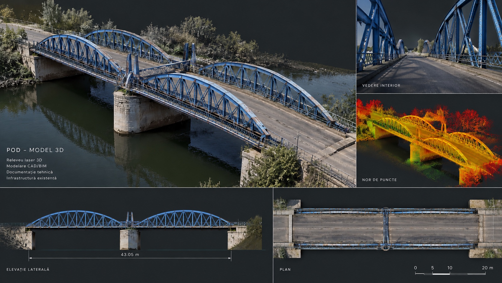
Bizetz Bridge, Giurgiu
An engineering monument opened in 1905. Two days of laser scanning and GNSS control produced a single geometric base: point cloud, topographic plan, elevations, sections and 3D model.
References
Have a corridor or network to document?
Tell us what the designers need to check on the ground. We reply within 24 working hours, and we choose the right workflow once the requirements are clear: LiDAR for measurable geometry, GIS panoramic capture for visual inventory, or a combination. Indicative ranges: how much a 3D scan costs · contact.
Technical competence backed by certifications
The documents are public and can be checked in full. Open each certificate as a PDF.
Certificate C1833 · valid until 02.09.2027View the PDF certificate ↗ISO 14001:2015Environmental management system
Certificate M1098 · valid until 02.09.2027View the PDF certificate ↗ANCPI authorisationClass II · series RO-B-J no. 3476
valid until 27.05.2031View the PDF authorisation ↗