
Construction surveying.
The site runs on verified levels.
Setting out, construction monitoring, as-built and progress valuations for general contractors and builders. Our own GNSS RTK, robotic total station and laser scanning equipment; a team that has worked on motorways, railways and tramways, on both sides of the contract: for the contractor and for the client.
Four services, one responsible party.
Setting out. Axes, levels, structural elements, utilities, based on the design received in DWG or LandXML, with a setting-out report and control files.
Construction monitoring. Phased checks, cross sections, levels, deviations from the design, reported before they become rework or delays.
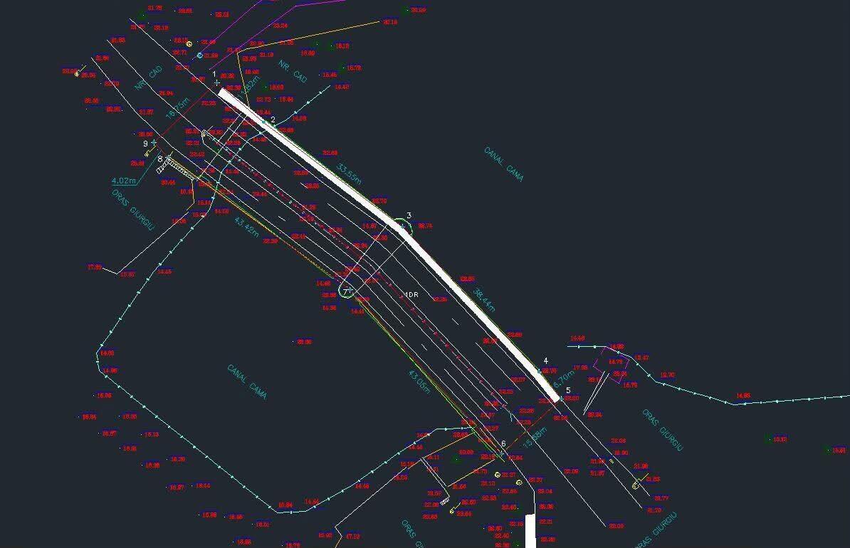
As-built survey. The as-built condition at the end of each phase: plans, profiles, utilities, in the format required by the client, consultant or operator.
Quantities and progress valuations. Earthwork volumes, areas, lengths, calculated on measurements, not estimates, as the basis for payment valuations.
We measure, check and hand over. Design, assessments and site supervision stay with the specialists contracted by the builder.
On your project, in your coordinate system, with a report at every phase.
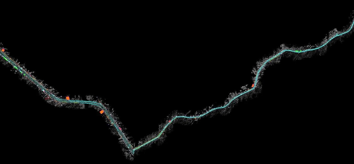
We take over the design, check the control network and complete it where missing, then work in Stereo 70 or in the site’s local system, with the transformations clarified before the first measurement. For large areas, with traffic or linear infrastructure, we use laser scanning and mobile mapping: we measure a 100 km road in two days, and the point cloud stays available for dimensions requested later. Every phase closes with a report: what was measured, the deviations, the files handed over.
Technical sheet
| GNSS RTK | Trimble R12 and R10 |
|---|---|
| Total station | Trimble S6, robotic |
| Laser scanning | Riegl VZ-400i, Trimble TX8 |
| Mobile mapping | Riegl mobile LiDAR system, up to 60–80 km/day |
| UAV | photogrammetry: orthophoto and digital terrain model |
| Software | Trimble Business Center, AutoCAD / TopoLT, RiSCAN Pro, CloudCompare |
| Authorisations | ANCPI category 2 (company), authorised persons classes B and D · ISO 9001 and 14001 |
| Formats delivered | DWG, LandXML, signed PDF, E57 / LAS, Excel for quantities, survey reports |
Sites, networks and infrastructure we have measured.
- Water and sewer networks, more than 50 kmsurvey support during construction and as-built surveys for acceptance and handover to the operator
- Gas networks — Călimănești, the whole town, and Bujoreni communetopographic surveys for the design and construction of the distribution network
- Brezoi – Călimănești gas pipelinetopographic analysis of the connecting route
- Olt Valley — slopesrock identification and topographic plan for slope analysis
- 7 Spice silos and industrial buildings, Râmnicu Vâlceasurvey support during construction
- Diana abattoir, Râmnicu Vâlceasite works and survey support during construction
- Kaufland area, Tudor Vladimirescu Blvd., Râmnicu Vâlceadevelopment of the area, with the on and off ramps from Ostroveni and related works
- DJ 607B — 100 kmmobile mapping in 2 days, terrestrial scanning of the bridges, topographic plan for modernisation
- DN 7Amobile and terrestrial scanning for modernisation
- Nădlactown topography for the LV/MV electricity network
Motorway, railway, tramway: from the contractor to the client.
The surveying engineer who leads 3D Discovery’s survey work has worked, before and alongside the company, in the contractor, consultant and client teams of major infrastructure projects:
- A10 Sebeș – Turda motorway, lot 2 (km 17+000 – 41+250)surveying engineer, construction
- Pan-European rail Corridor IV, Glogovăț – Border, upgrade for 160 km/hsurveying engineer, construction
- Ploiești – Buzău motorway, lot 2 Mizil – Pietroasele (km 21+000 – 49+350)surveying engineer, consultancy and supervision
- Tramway line and road system, Liviu Rebreanu Blvd., Bucharestsurveying engineer, construction
- Street rehabilitation in Bucharest — Virtuții, Pontonierilor, Imașului, Carelor, Sântimbru, Toplet, Pecinișca, Vârtejului, Perinița, Splaiul Independențeisurveying engineer, construction
- DN5 – Ring Road – Friendship Bridge link road, Giurgiucontract manager for the client
We know what the client and the consultant check. So we know what the contractor must hand over so the progress valuation is not rejected.
Frequently asked questions
Do you work on a day rate or on contract?
For long-running sites, on a monthly or phased contract, with a dedicated team and equipment. For one-off work (setting out, as-built, a day of scanning), by the day or by the job. On-site scanning with scanner and operator starts at 600 EUR/day, with the georeferenced point cloud delivered in 48h.
Can you take over a site already under construction?
Yes. We check the existing control network, document the coordinate system and the deviations from the design, then continue in the same reference, so there are never two “truths” on site.
Can you calculate quantities for progress valuations?
Yes. Earthwork volumes, areas and lengths, calculated on measurements and on the methodology agreed with the client or consultant, as the basis for payment valuations.
Which formats do you hand over?
DWG, LandXML, signed PDF, E57 or LAS for the point cloud, Excel quantity tables and survey reports. In the format required by the consultant or client.
Do you also deliver the point cloud?
Yes, when scanning is part of the service: georeferenced, in E57 or LAS. Later dimensions can be extracted without another site visit only for elements captured well enough and with the necessary accuracy.
Do you also do design, assessments or site supervision?
No. We measure, set out, check and hand over. The design, assessments and site supervision stay with the specialists contracted by the builder.
Do you cover the whole country?
Yes. Our teams work from Bucharest and Râmnicu Vâlcea; for long-running sites we mobilise a dedicated team for the duration of the works.
Related services: mobile mapping · topographic plan · indicative prices.
Have a site starting or a phase to hand over?
Send us the location, the type of works and the deadline. We reply within 24 working hours with the right team, equipment and pricing model. The firm quote follows once we have the full details of the works.