
How we turn a 3D scan into a measured survey and an Archicad model that design work can start from.
Think of a 3D scan as a three-dimensional photograph of the building, made of millions of points, that you can move through, where you can see the real geometry, take measurements and extract the information the project needs. That is probably the simplest explanation of a point cloud.
In reality, though, there is still a fair amount of work between the moment we finish scanning and the moment an architect can start designing.
There is a lot of talk about 3D scanning, BIM, digitalisation and impressive amounts of data, but much less about what the designer actually receives once the survey team has left the site.
They might receive an excellent point cloud of tens or even hundreds of gigabytes that they have to organise themselves. They might receive a few E57 files. They might receive 2D drawings. Or they might receive a model already prepared so that design work can actually begin.
From our point of view, the difference between these options matters. For us, scanning doesn’t end when the scanner goes back in the van.
What happens after scanning
On site we capture the building from several positions, depending on its geometry and on what we have to deliver at the end. A simple building may need relatively few positions, while in a large complex with several wings, levels, circulation routes and hard-to-reach areas, the volume of data grows very quickly.
After the fieldwork, the scans have to be brought into one coherent system and checked. We look at whether the links are correct, whether any areas are missing, whether the geometry closes and whether we have enough information for what the architect will do next.
Only then does the actual preparation of the cloud begin. On large projects we organise it so that it can be used normally, sometimes by wing, sometimes by level or by work zone. We remove information that isn’t needed and try not to carry more data into the project than is useful.
Because a bigger point cloud is not automatically a better point cloud for design.
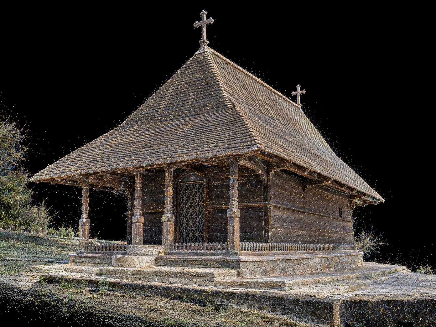
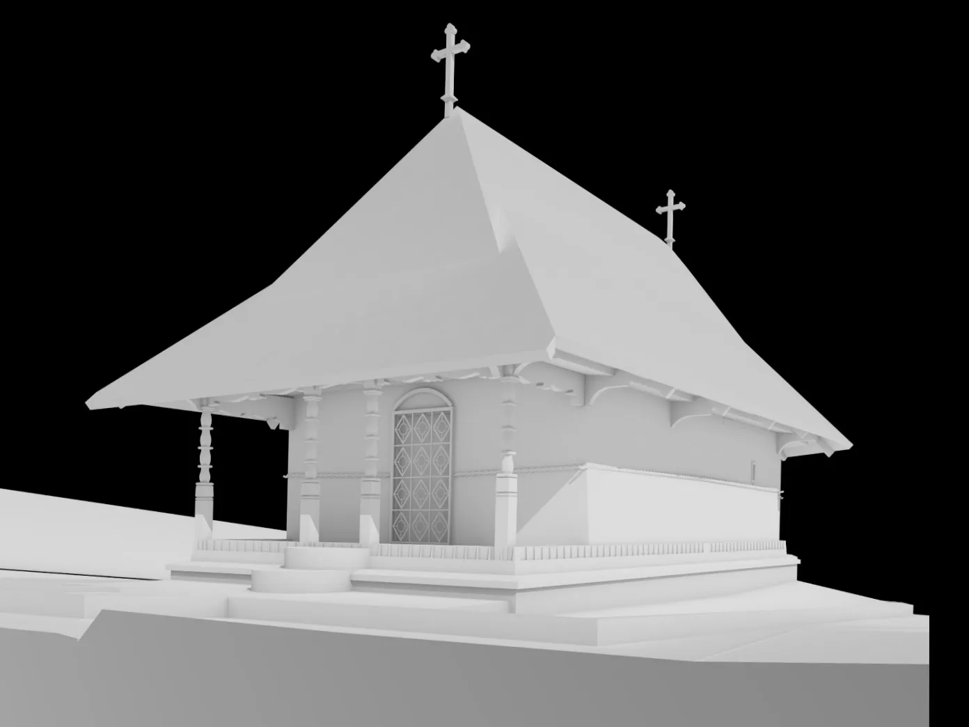
From here the data can go to Archicad, where we use the measured geometry as the basis for modelling. In plan we check walls, openings, columns and the position of key elements; in section we follow levels, floor slabs, roofs, vaults and how the different parts of the building connect. If an area is more complicated, we check it in 3D as well.
It is not an automatic process, and I don’t think it should be presented as one. The point cloud tells us what exists on site. Someone still has to understand that information and build the model.
Dintr-un Lemn Monastery
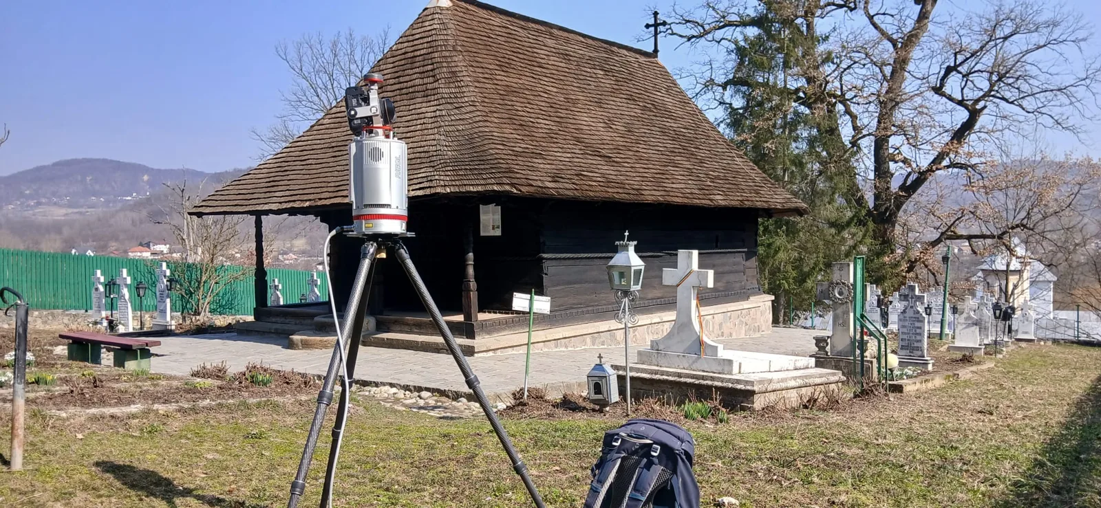
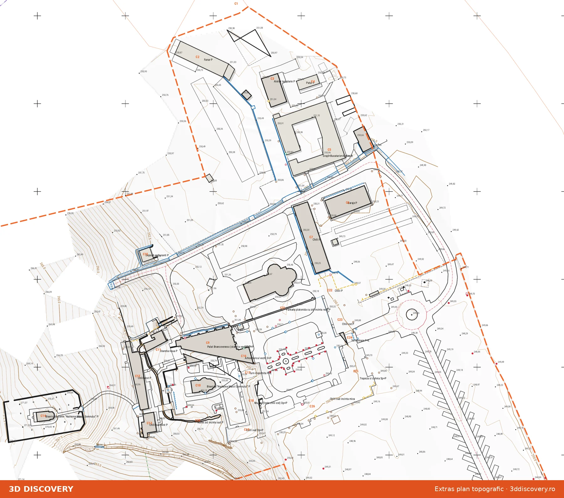
At Dintr-un Lemn Monastery the building was relatively small, so the scanning itself, with a RIEGL VZ-400i, took only a few hours. Including processing and data preparation, the scanning part was closed in one day, followed by about four days of modelling. At the end we delivered the 3D model, the architectural drawings and the complete topographic survey.
Small as it is, the building’s geometry is far more interesting than it looks at first. With an old timber building you can’t start from the assumption that walls are perfectly straight, that all elements are aligned, or that the roof follows the geometry you would draw if you designed the building today.
Working on the point cloud, you see these things very quickly. You can see how a wall drifts, where a direction changes, or where two elements that look aligned in photos are not actually aligned.
That doesn’t mean we have to model every deviation of a few millimetres. It only means we have the information and can decide what matters for the project and what can be simplified without falsifying the building.
Ploiești Cathedral
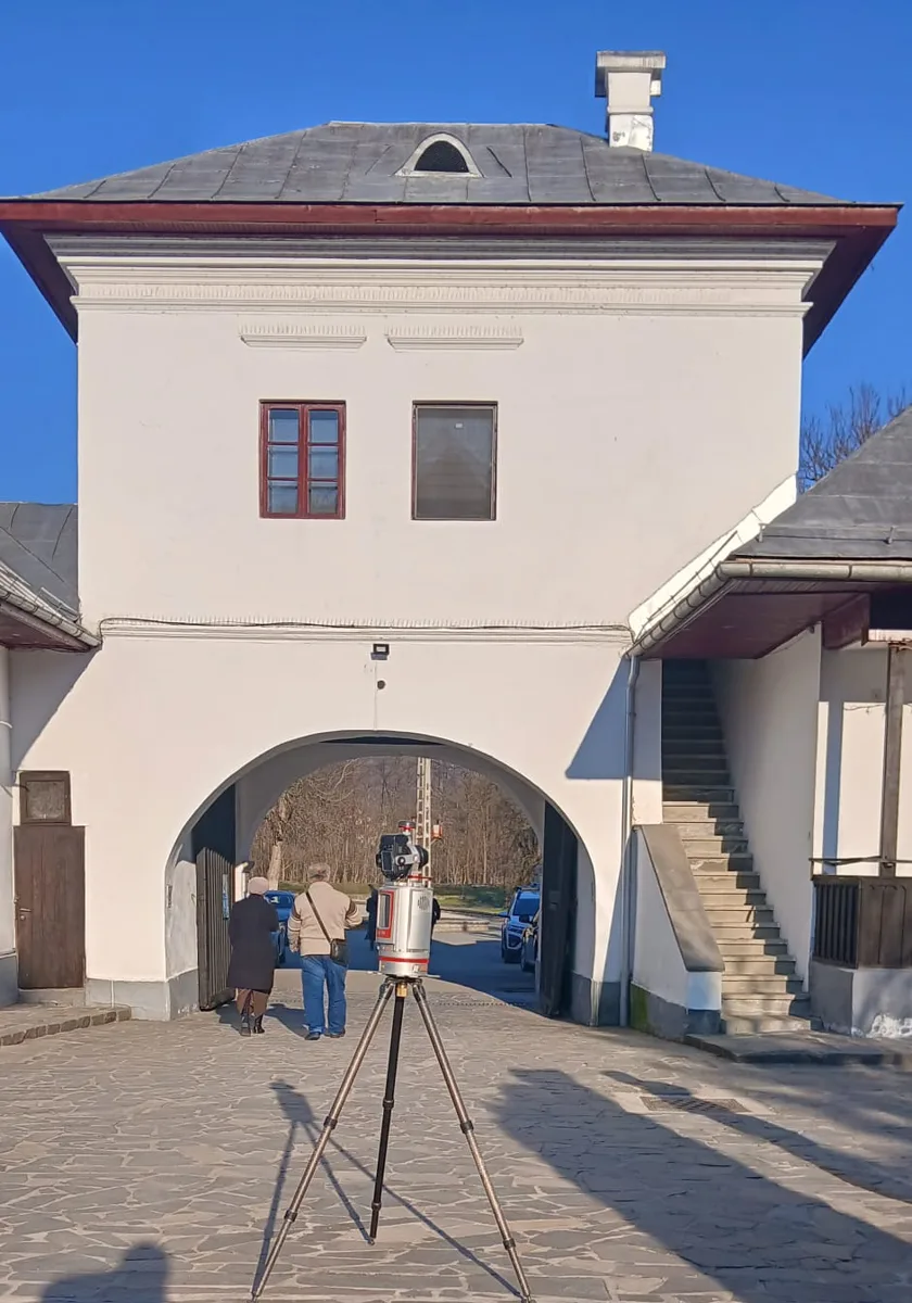
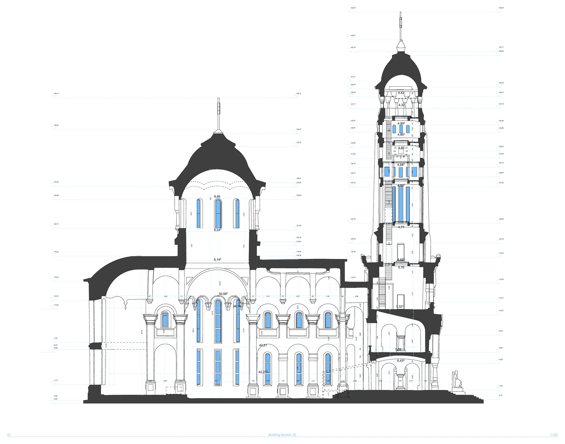
At St John the Baptist Cathedral in Ploiești the situation was different. The complete scan, inside and out, was done in one day. About two days of processing and data preparation followed, and producing the 2D drawings took about nine more days. We also delivered the complete topographic survey.
A cathedral has large volumes, towers, domes, arches, openings, several levels and a great many geometric relationships that have to be followed together. In situations like this, the advantage of the point cloud shows mostly when something doesn’t fit in the drawing. Instead of assuming how it should be, we go back to the measurement and check.
Sometimes you find that the problem isn’t the drawing. The building really is like that.
And that is one of the values of a complete survey: you no longer rebuild the building from fragments and assumptions; you can always go back to the existing geometry.
The Elias Ward, Băile Olănești
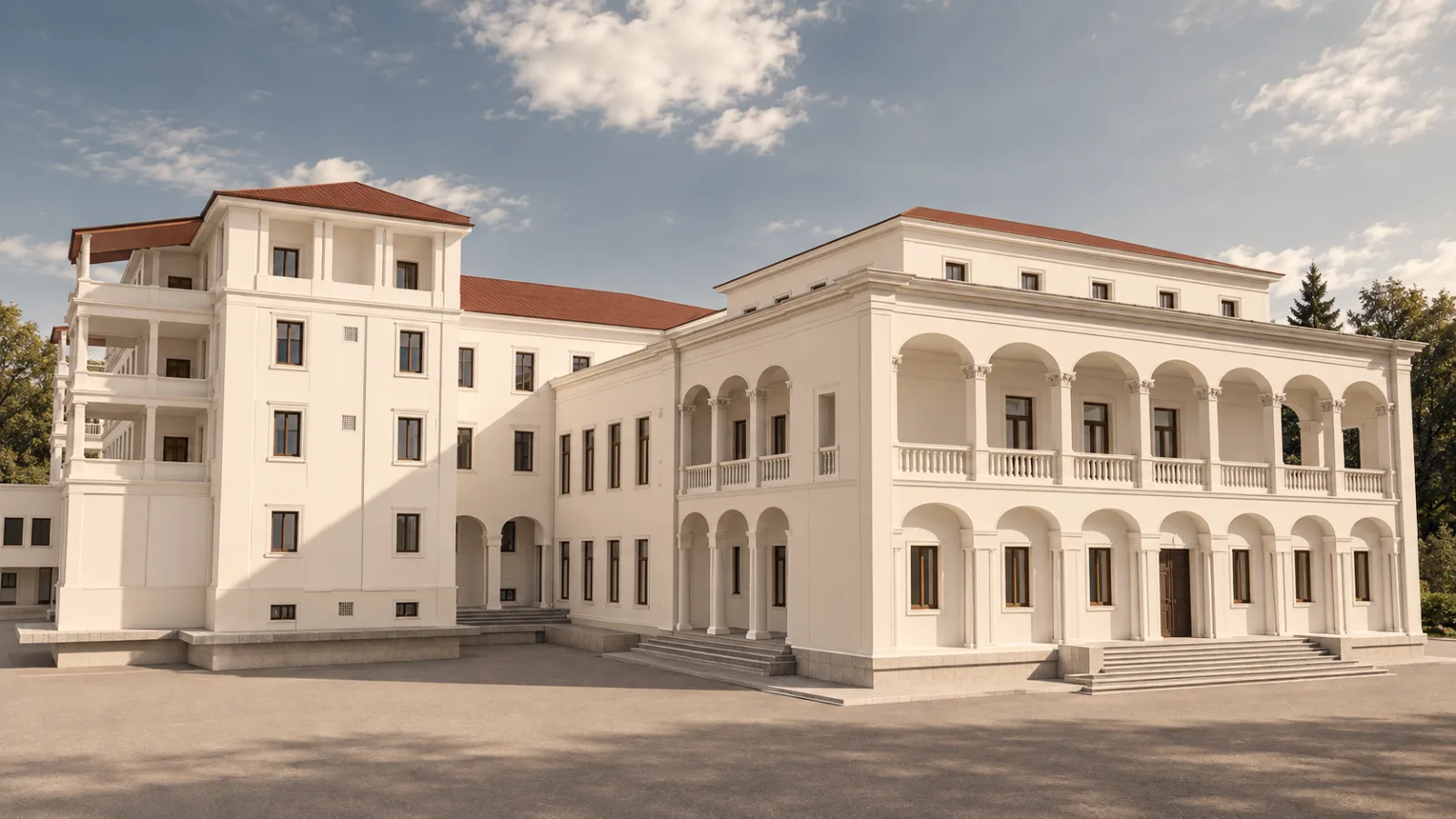
At Elias, the scale of the project changed the way of working again. We are talking about roughly 14,000 sq m, inside and out, with several connected wings, level differences, arcades, columns and generous circulation. Scanning took seven days, and after data preparation two architects spent about a month modelling the existing building.
At this size it is no longer enough for each room to be correct on its own. The whole complex has to fit together. Levels between wings have to be right, circulation routes have to meet where they meet in reality, and slabs and façades have to stay in the same geometry.
If you treat each wing separately and try to fit them together afterwards, you can easily end up with differences that carry through the design. Having all measurements start from the same geometric system helps us avoid exactly that.
The architect shouldn’t receive the raw material
In a conversation with our colleagues at Cadware, a comparison came up that I found very apt. If an architect orders a scanning service and ends up with a huge file they have to clean, cut, organise and prepare themselves, it is a bit like ordering a portion of chips and receiving a sack of potatoes.
The raw material is there and may be very good, but there is still a lot of work before it becomes what they needed.
I think our role should be clearer here too. We don’t want to move the complicated processing onto the architect’s desk. They shouldn’t have to become a point-cloud specialist just because they are working on a scanned building. They need to be able to use the information.
Why Archicad
The answer is very practical: many of the architecture practices we work with use Archicad. If the project is going to continue there, it makes sense to prepare the existing condition in a form the team can keep using.
Plans, sections and elevations then come from the same geometry, and if a check against the cloud shows that an element needs correcting, the correction is made in the model and carries through the drawings. On large projects this matters a lot, because it reduces the risk of a plan being updated while a section or an elevation lags behind.
It must be said clearly, however, that Archicad, like other BIM programs, is not specialised software for processing point clouds, and that is not its purpose. The cloud can be used very well as a reference, but the data has to be prepared before it gets there. That is where an important part of our work lies.
2D drawings or a BIM model?
I don’t think every project needs to become a BIM exercise just because it is technically possible. It is more useful to start from what the designer needs.
In some projects the final result may be a complete Archicad model, in others plans, sections and elevations, and sometimes the client also needs IFC, DWG, PDF, the E57 point cloud or the topographic survey.
There are also cases where the 2D drawings are generated from the model built in Archicad. In that case, even if the client asks for DWG at the end, the model remains the basis the documentation comes from. That is why the question “do we need 2D or 3D?” is not always as simple as it seems.
What matters more is agreeing what the designer will do with the information and what they need to be able to check later. Delivery options are described on the BIM modelling from 3D scanning page.
How much of reality should be modelled?
I don’t think there is one answer for every project. Not every unevenness and not every imperfection the scanner sees has to be modelled.
A structural strengthening project needs certain information, a restoration project needs other information, and a building services or fit-out project looks at different elements again.
That is why we try to talk to the designer before modelling and understand what they are going to do. The better we know what the model is for, the better we can decide what to keep, what to simplify and where more detail is needed.
Cadware, more than licensing
The Archicad licences we use are supplied by CADWARE Engineering, but our collaboration with the Cadware team has never been limited to buying software. Whenever we had questions, unusual situations, or wanted to check a particular way of working, their people were there and helped us.
This ongoing support matters a lot to us, especially because we use Archicad in production, on existing buildings and on projects where real geometry doesn’t always behave like a textbook example. Particular situations come up, large projects come up, questions come up about how best to organise information, and having a partner we can discuss these things with is important.
Even this article benefited from our conversations with the Cadware team, because they made us state more clearly a problem we also run into: a BIM program can use a point cloud very well, but the architect’s experience depends enormously on how the data was prepared before it reached them.
Maybe the question needs to change
In 3D scanning, the conversation quickly turns to equipment, accuracy, billions of points and dataset size. All of these matter and, of course, we care about them too.
But for the designer the more useful question may be a different one: what do I receive at the end, and how much work is left before I can start designing?
For me, that is where the quality of a reality capture service shows: not necessarily in the number of billions of points, the file size or a spectacular image of the cloud, but in how well you manage to turn measured reality into information another specialist can use.
In the end, the scanner can capture the building very well. Our job is to make sure that information reaches the architect in a form that is truly useful to them.
And maybe this is a question worth asking as an industry: when we say we have digitised a building, are we talking about the amount of data we captured, or about how easily the next specialist can work with it?
If you are working on an existing building, see the sample measured survey from 3D scanning or how we approach 3D scanning of buildings.